Report to/Rapport au :
02 October 2008 /
le 02 octobre 2008
Submitted by/Soumis par : Nancy Schepers, Deputy City Manager/Directrice municipale adjointe,
Planning, Transit and the Environment/Urbanisme,
Transport en commun et Environnement
Contact Person/Personne-ressource : Danny Page,
Acting Manager/Gestionnaire par intérim, Development Approvals/Approbation
des demandes d'aménagement
(613) 580-2424, 27595 Danny.Page@ottawa.ca
REPORT RECOMMENDATIONS
That Council:
1.
Refuse an amendment to the
former Township of Osgoode Zoning By-law, to change the zoning of Part of 1149
Yorks Corners Road from Rural (RU) to Residential (R), as shown in Document 1.
2.
Refuse an amendment to the New
Comprehensive Zoning By-law to change the zoning of Part of 1149 Yorks Corners
Road from Agriculture Zone 3 (AG3) to Rural Residential 4 (RR4), as shown in
Document 1.
RECOMMANDATIONS DU
RAPPORT
Que le Conseil :
1.
de
refuser une modification au Règlement municipal de l’ancien Canton d’Osgoode
visant à changer le zonage d’une partie de la propriété située au 1149, chemin
Yorks Corners, de Zone rurale (RU) à Zone résidentielle (R), comme le montre le
document 1.
2.
de
refuser une modification au nouveau Règlement de zonage général visant à
changer le zonage d’une partie de la propriété située au 1149, chemin Yorks
Corners de Zone agricole 3 (AG3) à Zone résidentielle rurale 4 (RR4), comme le
montre le document 1.
BACKGROUND
The purpose of
the subject application is to amend to the former Township of Osgoode Zoning
By-law to change the zoning on a part of the property addressed as 1149 Yorks
Corners Road. The property is 16.8
hectares in area and the part subject to rezoning is approximately
1.2 hectares in area. The site is
situated on the east side of Yorks Corners Road, south of Mitch Owens
Road. The site is vacant and is
situated south of the hamlet of Edwards.
Rural residential lots exist to the west, north, and south of the
site. Vacant lands zoned Rural exist to
the east of the subject land.
The property is zoned Rural (RU) under the former Township of Osgoode Zoning By-law.
The applicant wishes to amend the Rural zone for a part of 1149 Yorks Corners Road. By amending the Rural zone for a part of 1149 Yorks Corners Road, the applicant was originally hoping to sever three residential lots but has now amended his request to seek the rezoning to eventually allow the severance of two residential lots. This Zoning By-law amendment request precedes any application for severances.
Purpose of Zoning Amendment
The applicant is seeking to rezone part of 1149 Yorks Corners Road to permit two privately‑serviced residential lots having a minimum area of 6,000 square metres and 40 metres of frontage. The depth proposed for each lot is 150 metres.
According to the former Township of Osgoode Zoning By-law 2003-230, the subject land is zoned “Rural (RU)”. The permitted main uses within a Rural Zone are a single-detached dwelling, an agricultural use and a forestry use. This zone also permits an animal kennel and other uses. The minimum lot area for single detached dwelling is 10 hectares. The minimum lot frontage allowed under the By-law for a single detached dwelling is 182.8 metres.
The Comprehensive Zoning By-law has the subject land zoned Agriculture
Zone 3 (AG3). This zone has similar
permitted uses and standards as those of the aforementioned Rural Zone. The only difference between this zone and
the Rural zone is the lot frontage requirement under AG3 is 60 metres.
The applicant is requesting for the property to be rezoned to a zone that will permit a single detached dwelling on a lot size of approximately 6,000 square metres with a maximum of 40 metres frontage. The closest zone within the former Township of Osgoode Zoning By-law that matches the applicant’s request is “Residential (R)” which permits a residential use on minimum lot area size of 1,393.5 square metres and with a minimum lot frontage of 30.4 metres.
The Comprehensive Zoning By-law was passed by City Council on June 25, 2008. In the Comprehensive Zoning By-law, a zone that will permit a residential use on a lot that is approximately 6,000 square metres with 40 metres of frontage is Rural Residential Zone 4 (RR4). The minimum lot area and frontage permitted for RR4 is 4,000 square metres and 30 metres, respectively.
DISCUSSION
Provincial Policy Statement
The subject land is within a prime agricultural area. In prime agricultural areas, permitted uses and activities are limited to agricultural uses and agriculture-related uses. Agriculture-related uses are those that are farm-related commercial and farm-related industrial uses that are small in scale and directly related to the farm operation and are required in close proximity to the farm operation. Any proposed use shall be compatible with agriculture and shall not hinder surrounding agricultural operations.
Land can only be excluded from prime agricultural area for limited non-residential uses, provided that the land does not comprise a specialty crop area, there is a demonstrated need within the planning horizon for additional land to be designated to accommodate the proposed use, there are no reasonable alternative locations which avoid prime agricultural area.
The proposed use that is being considered under this Zoning By-law Amendment is not considered compatible with agriculture and cannot be considered an agricultural related use. It is a type of use that will impede surrounding agricultural operations when in proximity to farm operations. The proposed lots are not considered to be farm-related commercial or farm-related industrial. Moreover, the proposal further contravenes the Provincial Policy Statement, as there is no demonstrated need identified within the planning horizon for additional land to be designated to accommodate the proposed use and numerous reasonable alternative locations exist which avoid prime agricultural areas.
The Provincial Policy Statement does not support the
creation of residential uses within a prime agricultural area. According to the 2005 Provincial Policy
Statement, lot creation in prime agricultural areas is discouraged and may only
be permitted for: a) agricultural uses; b) agriculture-related uses; c) a
residence surplus to a farming operation as a result of farm consolidation; and,
d) for infrastructure – where the facility of corridor cannot be accommodated
through the use of easements or rights-of-way.
In the applicant’s case, not one of the aforementioned criteria can be
used as the basis to rezone the lands for a residential use.
Any other residential development proposal should be redirected to lands designated Village or within the urban boundary’s residential zones where there is sufficient and adequate servicing capacity.
Official Plan
According to the Official Plan, the subject land is designated “Agricultural Resource Area”. The Official Plan recognizes the importance of protecting and preserving this vital resource from loss to other uses. It is intended to protect the major areas of agricultural production and other lands suitable for agriculture from loss to other uses. It also ensures that uses that would result in conflicts with agricultural operations are not established in productive farming areas. Residential severances are only permitted for very limited farm related purposes. The creation of new non-farm residential lots is generally not permitted. As well, all new farm and non‑farm development, including severances, must comply with the Minimum Distance Separation formulae, as amended from time to time.
Within the Official Plan, the policies state that residential uses that would result in conflicts with agricultural operations are not to be established. Accordingly, all new farm and non-farm development, including severances, must comply with the Minimum Distance Separation formulae. Data to calculate the MDS has not been submitted to date by the applicant.
The introduction of residential uses into an agricultural area may hinder the expansion of farm operations, by limiting the expansion or introduction of barns and manure storage facilities within the general vicinity. Land uses, other than an agricultural use, are to be strictly limited to uses directly related to agriculture and agriculturally-related uses.
Policies also exist to safeguard the integrity of groundwater resources, and as such, the City is to consider the potential for impact on groundwater resources. In this case, the part requested to be rezoned has been identified as lands that play a role in the management of the groundwater resource. In response, the applicant submitted a hydrogeological study for the City to assess the appropriateness of the proposed residential uses. Consequently, several addendums to the hydrogeological study were received September 21, September 30 and October 1, 2008. A comprehensive review of the technical results still do not provide satisfactory confirmation that the part subject to the application is an appropriate location for two new privately serviced residential uses.
The policies of the Official Plan do not support the
creation of two residential parcels within a prime agricultural area. In fact, even if the lands were designated
General Rural, only one severance would have to be considered.
City and Conservation Authority
hydrogeology professionals have both reviewed the latest submissions. It is the opinion of both the City and
Conservation Authority that provincial requirements for water quality and
quantity testing have not been met.
Concerns remain with respect to the availability of groundwater supply
for human consumption and domestic use due to the potential of septic and
surficial contaminants in the drinking water supply aquifer.
Water quality information from a test well on the site and three neighbouring wells within 100 metres has been provided in support of the proposal to develop two single-detached residential uses. Section 4.4.1 of the Ministry of Environment Procedure D-5-5 states “It is the consultant’s responsibility to address water quality changes over time and to demonstrate that the water quality data are representative of the quality of water which future residents can expect in the long term.” In order to order to predict the long-term water quality Ministry of Environment Procedure D-5-5 states that all test wells must be subjected to a pumping test, which will provide a representation of long-term water quality and quantity for a residential use. In the applicant’s case, a test well was dug on site but a proper pump test was not conducted. Only one water sample was analysed for water quality results and this does not satisfy Ministry of Environment Procedure D-5-5 and is required in order to determine the long-term water capacity and quality the residential uses would be subjected to. It should be noted that although not done in accordance with provincial requirements, the well was pumped dry a number of times, which suggests that provision of sufficient quantity is questionable. In the absence of the necessary data, water quality of existing neighbouring wells is assumed to be representative of water quality, as these existing wells have been in use for a long time and are located in the same overburden aquifer as the subject site’s test well.
Health and aesthetic parameters must form the basis of determining whether a sustainable and safe drinking water supply is available. Section 4.1 of Ministry of Environment Procedure D-5-5 reads, “With respect to quality, each future domestic well must provide water that is safe and aesthetically suitable for human consumption.” Water quality samples from three existing neighbouring wells did not meet Ontario Drinking Water Objectives (ODWO) and/or Ontario Drinking Water Standards Objectives and Guidelines prescribed in the Technical Support document (ODWSOG). There were exceedances in total coliforms (health related parameter), and aesthetic related parameters of alkalinity, chloride, color, hardness, iron, organic nitrogen, sodium, Total Dissolved Solids and turbidity. Two of the neighbouring wells also showed surficial (road salt, etc.) and faecal impacts on the drinking water supplies. Sodium and chloride levels were above the maximum concentrations considered “reasonably treatable”, pursuant to Ministry of Environment Procedure D-5-5.
The on-site well also showed
aesthetic exceedances as per ODWO and ODWSOG for hardness, organic nitrogen,
turbidity and Total Dissolved Solids. The well also showed presence of faecal
streptococcus and other background bacteria.
Furthermore, the test well showed presence of nitrates, dissolved
organic carbon, organic nitrogen and elevated levels of sodium and chlorides
which suggest that the drinking water supply is being impacted by potential
surficial or septic contaminants, and thus may not be a sustainable or safe
drinking water supply. This result is
consistent with the water quality results found in the neighbouring wells.
Ministry of Environment Procedure D-5-5 states that all test wells must be subjected to a pumping test. Since it has been concluded that the standard requisite pump test cannot be performed, this poses doubt that sufficient groundwater quantity is present. Standard procedure is to pump at 13.7 l/min for a minimum of 6 hours. As noted by the applicant’s consultant, “A pump test cannot be carried out in this type of overburden well.” Ministry of Environment Procedure D-5-5 provides a different testing procedure when the standard pump test cannot be performed (e.g. overburden well) under Section 4.3.2 “The only instance where rates lower than these may be used is where preliminary results indicate that the pumping test rate cannot be sustained in the long term, and consideration is given to systems which would compensate for low well yields. In this case, the rate of testing pumping may be decreased, but the duration must be proportionally increased such that the total amount pumped equals the amount that would have been pumped if the test had been conducted using the procedures minima discussed above.” The applicant’s consultant has not undertaken this alternative testing method to demonstrate that sufficient groundwater supply is available. Therefore, it cannot be concluded that sufficient water quantity is available on-site.
Furthermore, the construction of the test well failed to meet the requirements of the Ministry of Environment Procedure D-5-5 and consequently was not certified by the consultant to be in compliance with Ontario Regulation 903. According to Ministry of Environment Procedure D-5-5 “Test wells must be located and constructed in such a way as to permit the prediction of the quantity and quality of groundwater which domestic wells will supply in the future. Accordingly, the construction of these wells must be typical of wells which will be used in the development in the future, and must comply with Ontario Regulation 903, with the requirement of other jurisdictions, and with any additional specifications recommended by the consultant and/or the MOE.” Therefore, the test well or the data obtained from this well cannot be accepted as typical of the future wells.
There is considerable doubt as to the viability of the drinking water
supply and the ability to meet Provincial requirements based on the information
provided to date.
The outstanding issues that remain as of October 1, 2008 are:
1) Quantity
testing: Pump test is still required,
pursuant to Ministry of Environment Procedure D-5-5. The test well must meet provincial standards or Ontario
Regulation 903 and its amendments.
2) Well
construction: The consultant is unable to provide professional certification of
the test well, hence water quality data from this well cannot be relied upon to
determine long-term water quality. It
is staff’s opinion that it is not appropriate to suggest as has been done in
this case that after the severance, new wells will be constructed to meet
Regulation 903 and the Osgoode Well Construction By-law. Confirmation is required at this stage,
prior to establishing a right of use, that adequate water quantity and quality
exists within the current drinking water supply.
3) Long term, safe, representative groundwater quality: The consultant has not demonstrated that the quality of the groundwater is suitable or sustainable in the long term. Data from the surrounding neighbouring wells and the test well indicates possible septic and/or surficial contaminants in the water supply.
Other Planning Issues
The proposed zoning presents another concern in that the lands that are intended to remain in the Rural/Agricultural zone would be left with a frontage of only 21 meters. This is significantly below the AG3 Zone requirement of 60 metres. This frontage is located to the south of the most southerly proposed lot identified in Document 1. Within this 21 meter corridor there is a watercourse/municipal drain which further reduces the frontage on Yorks Corners Road. A frontage of less than 21 meters within the setback requirements from watercourses is not considered sufficient for the functional development of a 15.6-hectare lot that is to remain zoned Rural/Agricultural. It is important to consider that while the lot is currently vacant, a single-family residence could be constructed, at this time.
Summary
Staff do not support the proposed Zoning By-law amendment as it contravenes the Provincial Policy Statement and does not comply with the policies of the Official Plan. The rezoning the subject lands will result in the residual lands having insufficient frontage to meet the Rural zoning provisions. The frontage requirement under the Rural zone is 182.8 meters, whereas the residual frontage will be approximately 21 meters. The hydrogeological study and amendments submitted with this revised proposal continues to provide inconclusive evidence that there is sufficient water quantity or quality for two residential lots that are approximately 6,000 square meters each.
Staff recommend refusal of this Zoning By-law amendment application.
CONSULTATION
Notice of this application was carried out in accordance with the City's Public Notification and Consultation Policy. The Ward Councillor is aware of this application and the staff recommendation. The City received one objection from the public to this application. This objection is detailed in Document 2.
FINANCIAL IMPLICATIONS
N/A
SUPPORTING DOCUMENTATION
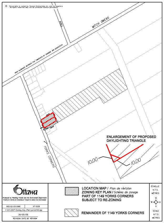
Document 1 Revised Location Map
Document 2 Consultation
REVISED LOCATION MAP DOCUMENT 1
CONSULTATION DOCUMENT 2
Notice of this application was carried out in accordance with the City's Public Notification and Consultation Policy. The Ward Councillor is aware of this application and the staff recommendation. The City received one objection from the public to this application. The neighbour was opposed to this proposal on the basis that:
- The proposed development is not in keeping with the lotting fabric (size and frontage) of the Edward hamlet’s single-family lots.
- There is a water quantity problem that exists within the area and shallow dug wells do not provide enough water in the summer months for existing lots of record.
- There is a water quality issue within the area and water is usually bacteria-laden for existing lots of record.
- Three more septic systems in close proximity to each other and to existing lots of record gives rise to the possibility of contamination for existing wells within the general area.