Report
to/Rapport au :
Planning and Environment Committee
Comité de l'urbanisme et de
l'environnement
and Council / et au Conseil
Submitted by/Soumis par : Ned Lathrop, Deputy City Manager/
Directeur municipal adjoint,
Planning and Growth Management /
Service de l'urbanisme et de la gestion de la croissance
Contact Person/Personne ressource : Grant Lindsay,
Manager / Gestionnaire
Development Approvals / Approbation des
demandes d'aménagement
(613) 580-2424 x13242,
Grant.Lindsay@ottawa.ca
|
SUBJECT: |
|
|
|
|
|
OBJET : |
REPORT RECOMMENDATION
That the Planning and Environment
Committee recommend Council approve an amendment to the former City of Kanata
Zoning By-law 161-93 to change the zoning of part of 900 Second Line Road to be
known as 47 Brady Avenue from R5A to R5A-exception as shown in Document 1 and
as detailed in Document 2.
RECOMMANDATION DU RAPPORT
Que le Comité de l'urbanisme et de l'environnement
recommande au Conseil d'approuver une modification au règlement de zonage
161-93 de l'ancienne Ville de Kanata visant à faire passer la désignation de
zonage de la partie du 900, chemin Second Line qui portera l'adresse municipale
47, avenue Brady, de R5A à R5A-exception, comme l'illustre le document 1 et le
précise le document 2.
BACKGROUND
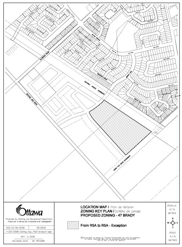
47 Brady Avenue has an area of approximately 5.5 hectares and is situated in the southwest corner of the Morgan’s Grant Community. It is north of the proposed extension of Brady Avenue, and immediately west of the Hydro Corridor.
The original conceptual design of Morgan’s Grant intended the subject lands to support the high-density residential development for the community. However, the applicant appealed the conceptual land uses in this area to the Ontario Municipal Board (OMB). The Board decided to allow the appeal and the high density was reduced to medium density residential development. As part of its decision the Board draft approved a plan of subdivision with stacked townhouses in the block originally intended for the apartment buildings. The Board also approved the appropriate Official Plan designation and zoning to accommodate the stacked townhouses.
Since that time, the applicant has determined that market conditions have changed to the point that they would rather produce street townhouses than stacked townhouses at this location. This proposed amendment would facilitate the development of 188 street townhouses.
DISCUSSION
The City Council Approved Official Plan
designates these lands as General Urban Area.
This designation permits all types and densities of housing
The former Regional Official Plan also
designates the lands as General Urban Area.
The policies in this Official Plan state that General Urban Areas are to
be used primarily for residential purposes although other supporting and
complementary uses are also permitted.
The former City of Kanata Official Plan
designates the lands High Density Residential.
Part of the OMB's decision included the approval of Official Plan
Amendment No. 58 to the City of Kanata Official Plan. The new policies allow the subject lands to be developed with
multiple attached, stacked and apartment dwelling units.
The existing zone is R5A. The zone provisions for street townhouses
within the R5A zone includes a reference to the zone provisions of the R3A
zone. The proposed zoning would
therefore require some exceptions to the zone provisions of the R3A zone. Specifically, it will result in a reduction
in allowable front yard and rear yard setback, and lot area. It will also allow
an increase in lot coverage.
The proposed zoning complies with the land use
designations of the City Council Approved Official Plan and the former Regional
Official Plan. The requested change is
to a similar zone that is found immediately west of the subject lands within
this phase of the Morgan's Grant Community.
The provisions within the R5A zone in addition to an increase in 15% in
lot coverage will result in a development in the urban area in keeping with
Council's approved land uses.
An application for a revised plan of
subdivision for these lands was submitted recently to reflect this Zoning
By-law amendment application. This
application has not yet received draft approval.
CONSULTATION
Notice of this application was carried
out in accordance with the City’s Public Notification and Consultation
Policy. The Ward Councillor is aware of
this application and the staff recommendation.
The City did not receive any negative comments or opposition to this
application.
FINANCIAL
IMPLICATIONS
APPLICATION PROCESS
TIMELINE STATUS
This application was processed by the "On-Time
Decision Date" established for the processing of Zoning By-law amendment
applications.
SUPPORTING DOCUMENTATION
Document 1 Location Map
Document 2 Details
of Recommended Zoning
DISPOSITION
Corporate Services Department, City
Clerk's Branch to notify the owner Minto Developments Incorporated 427 - # 300
Laurier Avenue West, Ottawa, ON K1R 7Y2,
Signs.ca, 866 Campbell Avenue, Ottawa, ON
K2A 2C5, and Ghislain Lamarche, Program Manager, Assessment, Financial
Services Branch (Mail Code: 26-76) of City Council's decision.
Planning and Growth Management Department to
prepare the implementing by-law, forward to Legal Services Branch and undertake
the statutory notification.
Corporate Services Department, Legal Services
Branch to forward the implementing by-law to City Council.
Document 1
LOCATION MAP
Document 2
DETAILS OF RECOMMENDED ZONING
1. The subject property as shown on Document 1 is to be rezoned from R5A to R5A-exception
2. Subsection 9(3) is to be added to By-law 161-93 for special R5A zones.
3. A clause is to be added to Subsection 9(3) for the development of multiple attached dwellings (street townhousing) on the subject property including the following exceptions:
- minimum lot area 164 square metres
- minimum front yard depth 3.0
metres
- minimum rear yard depth for main building 6.0 metres
- maximum coverage for main building 55%