Report to/Rapport au :
Planning and Environment Committee
Comité de l'urbanisme
et de l'environnement
and Council / et au Conseil
25 January 2010 / le 25 janvier 2010
Submitted by/Soumis
par : Nancy Schepers, Deputy City
Manager/Directrice municipale adjointe,
Infrastructure Services and Community
Sustainability/Services d’infrastructure et Viabilité des collectivités
Contact Person/Personne-ressource : John Smit,
Manager/Gestionnaire, Development Review-Urban Services/Examen des projets
d'aménagement-Services urbains, Planning and Growth Management/Urbanisme et
Gestion de la croissance
(613) 580-2424, 13866
John.Smit@ottawa.ca
|
SUBJECT: |
|
|
|
|
|
OBJET : |
REPORT RECOMMENDATION
That the recommend Council approve an amendment to Zoning
By-law 2008-250 to change the zoning of 1630 Star Top Road from IL (Light
Industrial) to IL H(32) [xxxx] (Light Industrial – Height 32 metres –
Exception), as shown on Document 1 and as detailed in Document 2.
RECOMMANDATIONS
DU RAPPORT
Que le Comité de recommande au
Conseil d’approuver une modification au Règlement de zonage 2008-250 afin de
changer la désignation de zonage du 1630, chemin Star Top de IL (Zone
d’industrie légère) à IL H(32) [xxxx] (Zone d’industrie légère – hauteur 32 m -
exception), comme il est indiqué dans le Document 1 et expliqué en détail dans
le Document 2.
BACKGROUND
The
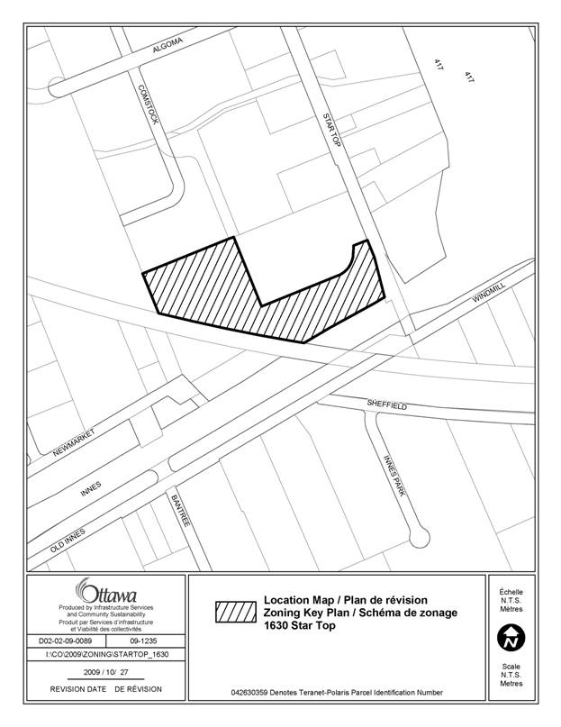
site is located at 1630 Star Top Road in ward 18 (Alta Vista). It is on the northwest corner of Star Top
Road and Innes Road just east of the Canadian National Railway. The 4.2-hectare
site currently has a one to two-storey light industrial/office building with
outdoor storage and surface parking. The
site is surrounded by existing light industrial uses, including an existing
four-storey office building to the northeast, a transportation warehouse to the
north, a snow disposal facility to the northwest, a masonry retailer across
Innes Road to the south , and a car dealership across Star Top Road to the
east.
Purpose
of Zoning Amendment
The purpose of this application
is to increase the permitted maximum building height from 18 metres to 32
metres. An eight-storey office building
is proposed on the site, which would exceed the 18-metre height limit, thus
necessitating a Zoning By-law amendment. No
change to the present maximum floor space index (i.e. density) of 2.0 is being
requested.
The site is currently zoned as IL (Light Industrial) in Zoning By-law 2008-250. This zone permits light industrial, office, and complementary uses with a maximum building height of 18 metres.
The proposed zoning is IL H(32) [xxxx] (Light Industrial – Height 32 metres – Exception).
DISCUSSION
Land Use Designation
The
site is designated as Employment Area on Schedule B of the Official Plan. This designation permits a variety of
industrial and office uses, along with supporting ancillary uses. The intent of the Employment Area designation
is to protect lands for these types of uses such that each employment area can
accommodate 2,000 jobs. They are located
at key locations where there is access to truck routes. The proposed Zoning By-law amendment does not
seek to change the permitted uses, and maintains the density provisions in the
current zoning. Despite this, the
proposed development will be more intense than the current use of the lands,
thereby contributing to the overall development of the existing employment area. The proposal maintains the intent of the
Employment Area designation in the Official Plan.
Compatibility and Design
When considering requests for additional height, consideration must be given to the Urban Design and Compatibility criteria in the Official Plan. The site does not abut any residential neighbourhoods and the area is characterized by a mix of low and medium rise light industrial buildings. Integration of taller buildings within an area characterized by a lower built form can be achieved through various physical means, such as setbacks and building massing. Given the large setbacks between buildings characteristic of this light industrial area, there will be an adequate transition between existing lower-rise buildings and the proposed eight-storey building. Furthermore, as the allowable density on the site will not change, the overall massing of the buildings is not expected to differ significantly from what is presently permitted. There is also less potential for impacts of height on light industrial uses than on residential uses. The proposed increase from 18 metres to 32 metres does not present any significant compatibility issues, and thus is in conformity with the general intent of the Official Plan.
Innes Road is an arterial road and is included as part of the Primary Transit Network as a Bus Rapid Transit corridor, with a potential station at Star Top Road. The details of the rapid transit corridor and station locations will be confirmed through the Hospital Link/Cumberland Transitway Connection Environmental Assessment, which is currently underway. Given the proximity of the site to the future rapid transit corridor, the Transit Oriented Development Design Guidelines provide additional direction for urban design. In particular, the highest density buildings should be located close to the street frontage and transit stop, and parking areas should not be located between the building and the street. Staff propose that a special provision be included in the zoning to require buildings to be located closer to the street edge at such time that the location of the rapid transit station is finalized. Until that time, staff are of the view that these specific design considerations can be adequately addressed through the Site Plan Control process.
Other Considerations
As this application does not request additional density, transportation and servicing aspects will be considered at the time of Site Plan Control application.
Summary
The proposed Zoning By-law amendment conforms to the Official Plan policies of the Employment Area designation. The increase in building height does not present any significant compatibility concerns, and design elements will be addressed through a future Site Plan Control application. Staff recommend that the zoning of the site be amended to increase the maximum building height from 18 metres to 32 metres.
RURAL IMPLICATIONS
N/A
CONSULTATION
Notice of this application was carried out in accordance with the City's Public Notification and Consultation Policy.
COMMENTS BY THE WARD COUNCILLOR(S)
The Ward Councillor is aware of the application.
LEGAL/RISK MANAGEMENT IMPLICATIONS
There are no legal/risk management implications associated with this report.
CITY STRATEGIC PLAN
The Planning and Growth Management priorities of the City’s Strategic Plan are upheld whereby the subject Zoning By-law amendment encourages the development of existing employment lands to promote job creation and minimize infrastructure costs.
TECHNICAL IMPLICATIONS
N/A
FINANCIAL IMPLICATIONS
N/A
APPLICATION PROCESS TIMELINE STATUS
This application was processed by the "On Time Decision Date" established for the processing of Zoning By-law amendment applications.
SUPPORTING DOCUMENTATION
Document 1 Location Map
Document 2 Details of Recommended Zoning
Document 3 Consultation Details
DISPOSITION
City Clerk and Solicitor Department, Legislative Services to notify the owner, applicant, OttawaScene.com, 174 Colonnade Road, Unit #33, Ottawa, ON K2E 7J5, Ghislain Lamarche, Program Manager, Assessment, Financial Services Branch (Mail Code: 26-76) of City Council’s decision.
Planning and Growth Management to prepare the implementing by-law, forward to Legal Services and undertake the statutory notification.
Legal Services to forward the implementing by-law to City Council.
LOCATION MAP DOCUMENT
1
DETAILS OF RECOMMENDED ZONING DOCUMENT 2
Proposed
Changes to the Comprehensive Zoning By-law
- The Zoning Map of City of Ottawa Zoning
By-law Number 2008-250 is amended by changing the zoning of the lands
known municipally as 1630 Star Top Road from
IL (Light Industrial) to IL H(32) [xxxx] (Light Industrial – Height
32 metres – Exception).
- Add a new exception and provisions to Section 239 as follows:
Where a lot is located within 600 metres of a rapid transit station identified on Schedules 2A and 2B of this by-law, the maximum front yard setback for a new building to be built on the lot is 10 metres.
CONSULTATION DETAILS DOCUMENT
3
NOTIFICATION AND CONSULTATION PROCESS
Notification and public consultation was undertaken in accordance with the Public Notification and Public Consultation Policy approved by City Council for Zoning By-law amendments. One (1) comment was received from the public related to this application.
PUBLIC COMMENTS
Comment:
My concern is related to the limited access and exit routes to this site. The access driveway is located very close to the intersection of Innes and Startop Rd. Currently, vehicles entering and exiting the existing office building frequently causes gridlock at the intersection. The proposed addition of 1034 more cars entering and exiting the single entrance/exit lane during peak business hours will totally block all traffic entering or exiting the entire Star Top - Algoma -Cyrville area.
Staff Response:
The details of site access, traffic, and parking, will be reviewed through a future Site Plan Control application.