|
2. OFFICIAL PLAN AMENDMENT -
NORTH GOWER SECONDARY PLAN MODIFICATION AU PLAN OFFICIEL - PLAN SECONDAIRE DE NORTH GOWER |
Committee
Recommendation
That Council
approve and adopt an amendment into the Official Plan to incorporate the North
Gower Secondary Plan into the Official Plan as detailed in Document 2.
Recommandation du comité
Que le Conseil approuve et adopte une
modification au Plan officiel visant à incorporer le Plan secondaire de North
Gower au Plan officiel, comme le précise le document 2.
Documentation
1. Deputy City Manager's report (Planning,
Transit and the Environment) dated
24 June 2008 (ACS2008-PTE-PLA-0127).
Report
to/Rapport au :
Agriculture and Rural Affairs Committee
Comité d'agriculture et des questions rurales
24 June 2008 / le 24 juin 2008
Submitted by/Soumis par Nancy Schepers, Deputy City Manager/
Directrice municipale adjointe,
Planning, Transit and the Environment/
Urbanisme, Transport en commun et
Environnement
Contact
Person/Personne Ressource : Richard Kilstrom, Manager / Gestionnaire, Community
Planning and Design / Approbation des demandes d'aménagement, Planning
Brancy/Direction de l'urbanisme
(613)
580-2424, 13242
Richard.Kilstrom@ottawa.ca
|
SUBJECT: |
OFFICIAL PLAN AMENDMENT - North Gower
Secondary Plan (FILE NO. [D01-01-08-0002]) |
|
|
|
|
OBJET : |
MODIFICATION AU
PLAN OFFICIEL – PLAN SECONDAIRE DE NORTH GOWER (DOSSIER NO D01-01-08-0002) |
REPORT
RECOMMENDATION
That the recommend Council approve and adopt an amendment to the Official Plan to incorporate
the North Gower Secondary Plan into the Official Plan as
detailed in Document 2.
RECOMMANDATION DU RAPPORT
Que le Comité de l’agriculture et des questions
rurales recommande au Conseil d’approuver et d’adopter une modification au Plan
officiel visant à incorporer le Plan secondaire de North Gower au Plan
officiel, comme le précise le document 2.
BACKGROUND
On January 23, 2008 City Council approved the North Gower Community Design Plan (CDP) and associated Official Plan and Zoning By-law Amendments after a collaborative planning process. This involved obtaining ideas and feedback from residents regarding the type of village they want in the future.
Other amendments approved by City Council in the above approval have been implemented or are in the process of being implemented. Since there were no appeals regarding the Official Plan Amendment to expand North Gower’s boundaries and to remove the North Gower Village Plan from the Official Plan Volume 2C, changes have been undertaken. Zoning changes approved by City Council to implement the North Gower CDP have been incorporated in the final version of the Draft Comprehensive Zoning By-law that is expected to be adopted by Council on June 25, 2008 and posted for statutory notice.
In its January approval of the North Gower CDP, City Council also directed “that the North Gower Community Design Plan be brought back to Committee in a Secondary Plan format and be incorporated in the Official Plan”. An Official Plan Amendment was therefore initiated in accordance with City Council direction, which has resulted in this report.
DISCUSSION
In accordance with City Council’s motion to incorporate the CDP as a Secondary Plan in the Official Plan, staff initiated an Official Plan Amendment process that would essentially organize the North Gower CDP into a format that would be suitable for incorporation into Volume 2C – Village Plans of the Official Plan.
Rationale
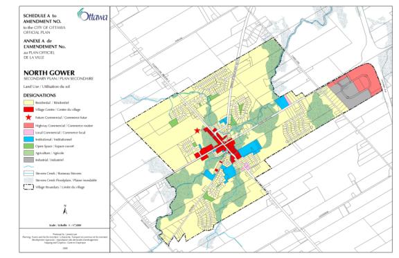
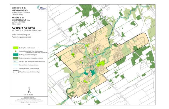
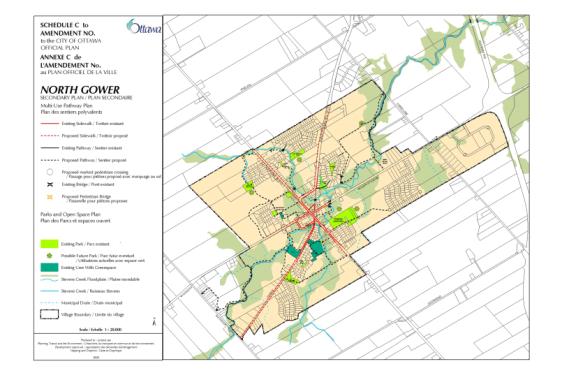
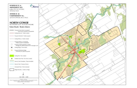
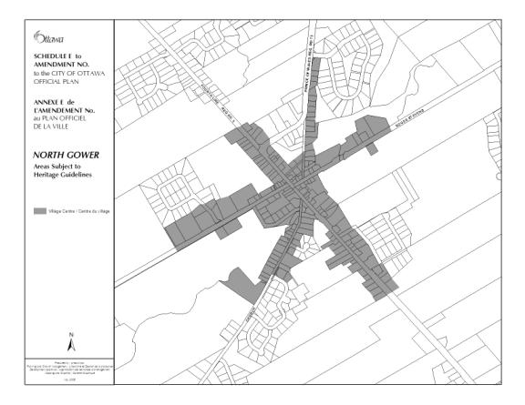
The Official Plan Amendment is recommended for approval since it essentially takes the City Council-approved North Gower CDP and adds those elements to the Official Plan that are essential to consider in future land-use planning decisions. Those components of the Secondary Plan include: i) vision, goals and objectives, ii) a land-use plan that identifies the proposed location of land-uses and associated policies, iii) a parks and open space plan and associated policies that will assist staff and developers in identifying future park locations as part of the subdivision approval process, iv) a multi-use pathway plan, v) proposals for the Village Centre vi) a future roads plan that will help to connect the village, and vii) an implementation component (see Document 2 – PART B – THE AMENDMENT).
These elements of the Secondary Plan have been taken from the North Gower CDP. Minor changes were made as a result of public circulation of the draft amendment. These are described in Document 3 – Consultation Details.
In summary, this amendment will add the North Gower Secondary Plan to the Official Plan Volume 2C- Village Plans.
This Official Plan Amendment provides Official Plan policies to direct growth in the village of North Gower.
CONSULTATION
Notice of this application was carried out in accordance with the City's Public Notification and Consultation Policy. The Ward Councillor is aware of this Official Plan Amendment and the staff recommendation.
Comments from the public dealt with matters of clarification and editorial suggestions. Detailed responses to the notification/circulation are provided in Document 3.
FINANCIAL IMPLICATIONS
There are no immediate financial implications associated
with this report. Any future
infrastructure requirements would be subject to an update to the LRFP or
inclusion in future capital budgets.
SUPPORTING DOCUMENTATION
Document 2 Proposed
Official Plan Amendment
Document 3 Consultation
Details
DISPOSITION
City Clerk’s Branch, Council and
Committee Services to notify
Ghislain Lamarche, Program Manager, Assessment, Financial Services Branch (Mail
Code: 26-76) of City Council’s
decision.
Planning,
Transit and the Environment Department to:
i) prepare the by-law adopting the Official Plan Amendment, forward to Legal Services Branch, and undertake the statutory notification and
ii) ii) revise Annex 7 Official Plan Rural Village Plans, to include a Secondary Plan for North Gower, upon final adoption of this Official Plan Amendment.
Legal Services Branch to forward the
implementing by-law to City Council.
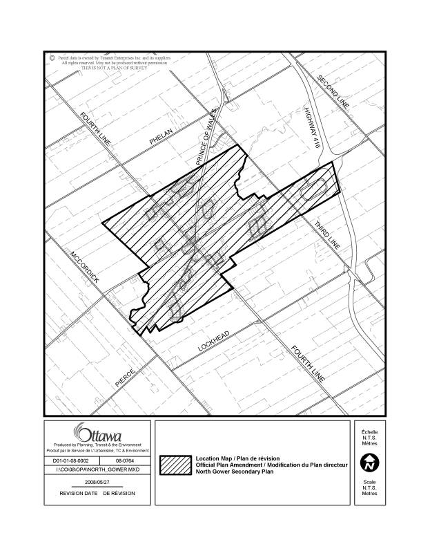
LOCATION MAP DOCUMENT
1
PROPOSED OFFICIAL PLAN AMENDMENT DOCUMENT
2

Official Plan Amendment ___/
Modification du Plan directeur __
to the
Official
Plan for the City of Ottawa
Official Plan Amendment
Official Plan for the City of Ottawa
Index
The Statement of
Components
Part
A – The Preamble
Purpose
Location
Basis
Part
B – The Amendment
Part
C – The Appendices
The Statement of
Components
Part A – The Preamble, introduces the actual Amendment but does not
constitute part of the Amendment No. ___ to the City of Ottawa.
Part B – The Amendment, consisting of the following text and schedules
constitutes the actual Amendment No. __ to the Official Plan for the City of
Ottawa.
Part C – The Appendices, does not form part of the Amendment but is provided
to clarify the intent and to supply background information related to the
Amendment.
PART A – THE
PREAMBLE
Table of Contents
1.0
Purpose ………………………………………….
2.0
Location …………………………………………
3.0
Basis …………………………………………….
3.1 Collaborative Planning Process …………
3.2 Historical Roots …………………………
3.3 Population ………………………………
3.4 Village Character ……………………….
3.5 Planning Context ……………………….
3.6 Strategic Directions …………………….
3.6.1 Growth Management ………...
3.6.2
Village
Character …………….
3.6.3
Infrastructure
…………………
1.0 PURPOSE
The purpose
of Amendment __ is to add the North Gower Secondary Plan to the Official
Plan. The North Gower Secondary
Plan is based on the North Gower Community Design Plan (CDP) approved by City
Council on January 23, 2008. The Secondary Plan will provide
greater planning detail than is found in the Official Plan on matters such as
land-use, stormwater and environmental management, design and roads.
2.0 LOCATION
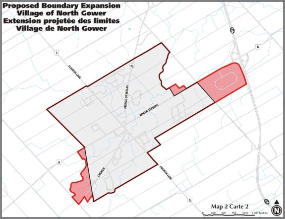
The lands affected by Amendment___ include all the lands located within North Gower’s village boundaries. Several areas adjacent to the village boundaries were recommended to be brought into the village as a result of the North Gower CDP through an Official Plan Amendment. This proposed expansion received final City Council approval on January 23, 2008.
3.0
BASIS
3.1 Collaborative Planning Process
This Official Plan Amendment (OPA) reflects the strong direction set in the North Gower CDP by residents with technical and research support provided by City of Ottawa staff. During the planning process, staff developed a collaborative process that built on the work that had already been undertaken by residents (the Design Group), who initiated preparation of a plan for their village. This process included information gathering and analysis by staff, meetings with the Design Group, and public consultations, which ultimately led to City Council approval of the North Gower CDP and further direction that a Secondary Plan to be prepared based on the approved plan.
Summarized below are some of the information-gathering activities and public consultations that took place during preparation of the North Gower CDP.
Information gathering
· Assessing available studies and data (i.e.: lot creation in the village) and initiating new work (i.e.: groundwater study, parks and open space plan)
· Identification and confirmation of village issues
· Assembly of heritage building and farming practices information by Design Group members
Consultations
· Two public meetings (June 2003 and March 2004) organized by the Design Group to obtain feedback on the “vision” for North Gower and the draft plan prepared by the group.
· Five presentations by planning and technical staff to the Design Group focused on planning policy and zoning, Rideau Valley Conservation Authority policies and practices, results of the groundwater study, natural systems in the village, and heritage buildings.
· A public workshop in June 2005, to present findings to date and to obtain feedback on the goals and objectives set for the Plan.
· A public meeting/open house in June 2006 to present the recommendations of the draft plan, including a park and multi-use pathway plan.
· A final public meeting/open house in January 2007 to present a revised plan based on public comments.
· A summary of public comments sent to residents on mailing list (April 2007) and a follow-up letter to the same outlining list of final changes to North Gower CDP (October 2007).
· Agriculture and Rural Affairs Committee meeting on January 10, 2008 and approval by City Council on January 23, 2008.
3.2 Historical Roots
North Gower’s historical roots extend back to the time of the original survey of the Township of North Gower, undertaken in 1791 by John Stegmann. The lots and concessions were surveyed in 1820. The same year, Stephen Blanchard, a lumberman, located the site of the present village. In 1823 a Methodist preacher, Peter Jones, and his wife, Anna Eastman, settled on Lot 18, Concession 4 and established a school and church in their log shanty home. Other Eastmans, the John Thomson family, Richard Pettapiece, William McEwan and several more pioneers followed. The Callenders, Wallaces, Dillons and Craigs arrived in the 1830s and the Moffats, Carsons and more Craigs in 1840.
By 1864, there were numerous residents providing a wide range of services to fellow villagers, which created a busy and active village. There were general stores (five), blacksmiths (five), shoemakers (five), hotel owners (two) and other useful trades of the day. It is the Design Group’s desire to once again have an active commercial area in the village.
3.3 Population
With an estimated population of 1,750 in 2004, North Gower ranks in the top one-third of the 26 villages in Ottawa in terms of size. Over the last 25 years (1975 – 2000), the number of dwellings in the village has more than doubled and was estimated at 574 in 2003. However, village growth in the former Rideau Township southwest of the urban area is dominated by Manotick - the largest village in Ottawa at a population of 5,200 in 2004 — while Richmond vies with Greely as the second largest village in Ottawa with a population of 4,330 (City of Ottawa Data Handbook, 2004).
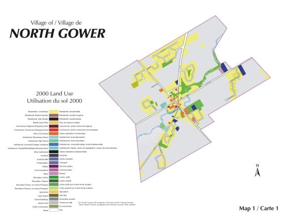
The village offers a wide array of services including a nursery school and recreational programs at the Alfred Taylor Recreation Centre, library, school, bowling lanes and archery lessons on Fourth Line Road, a seniors retirement home, repair services, post office, bank, library, school and convenience stores (see Map 2 – 2000 Land-use).
While there are no recent or reliable data on where North Gower residents work, their proximity to Highway 416 provides good access to workplaces throughout the rest of the city. The 2001 census found that throughout the rural area of Ottawa, 28 per cent of residents work in the rural area and another 60 per cent work within the urban area. The rest have no fixed place of work, or work outside Ottawa (City of Ottawa Data Handbook, 2004).
3.4 Village Character
 Much
of the village character is set by North Gower’s historic settlement, with many
of its original houses still intact. Clustered within the Village Centre (core),
North Gower’s heritage settlement demonstrates its unique character and defines
the village for its inhabitants and visitors alike.
Much
of the village character is set by North Gower’s historic settlement, with many
of its original houses still intact. Clustered within the Village Centre (core),
North Gower’s heritage settlement demonstrates its unique character and defines
the village for its inhabitants and visitors alike.
The Village Centre is also the social and commercial focus of North Gower. The mix of small-scale commercial and recreational facilities and mixed-use buildings defines North Gower as an active rural community. Collectively, they provide the village with a focus by providing some basic services.
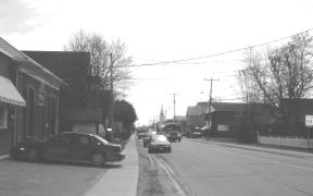
Five streets radiate in a star-shaped pattern from the core and each offers a mix of services and residences. For example, Roger Stevens Drive, connecting the centre of the village to Highway 416, includes a lumber yard and builders’ retail centre in the core, a farm supply store, a country market, a newly expanded fire station, a former township building used now as a meeting place, and a seniors’ residence.
Growth of the village has progressed outward from the core along the main roads. Beyond the Village Centre, several residential subdivisions provide primarily single-detached homes that are privately serviced. The subdivisions are developed as cul-de-sacs and P-loops off the main roads that define the village, with small parks in some areas.
The subdivisions are separated from each other and the rest
of the village by large expanses of vacant land. About two-thirds of the land
within the village is open and actively used for 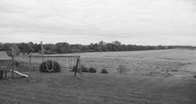 agriculture,
including land within the flood plain of Stevens Creek. Families who have lived in North Gower for
generations continue to farm within and around the village, even as it has
grown around them. Cash crops such as soy beans, corn, wheat and barley are
grown within the village, while dairy and livestock operations continue within
and adjacent to the village. The Design Group of North Gower prepared an
agricultural census, which is found in Appendix 1. It lists at least seven active farms within the village boundaries.
agriculture,
including land within the flood plain of Stevens Creek. Families who have lived in North Gower for
generations continue to farm within and around the village, even as it has
grown around them. Cash crops such as soy beans, corn, wheat and barley are
grown within the village, while dairy and livestock operations continue within
and adjacent to the village. The Design Group of North Gower prepared an
agricultural census, which is found in Appendix 1. It lists at least seven active farms within the village boundaries.
3.5 Planning Context
The Official
Plan provides a broad context for development in North Gower and other rural
communities. The Plan proposes that Ottawa’s villages be the focus of rural
growth because villages provide residents with the best access to services. As
well, focusing growth in villages results in the least impact on the rural
area, in terms of impacts on agricultural land and resource development. The
Plan sets criteria for an expansion of village boundaries, including the
availability of land for development within the village and the effect of the
expansion on agricultural land or other resource land.
Most of the
land surrounding North Gower is designated Agricultural Resource, where only
agricultural uses are permitted. The policies in the Plan are designed to
protect these lands from loss to other uses and ensure that other uses that
conflict with agricultural practices are not established in the area.
In 2000, North Gower’s existing land-uses (see Map 2) show that vacant
lands, predominantly agricultural lands outside the floodplain, represent about
65 per cent of all lands within the village. About 19 per cent of lands are
used for low-density residential uses. Paved roads represent almost 7 per cent
of land-uses while commercial, industrial and institutional uses account for
just over 2 per cent of all land-uses.
Other
policies in the Official Plan set broad directions that affect many aspects of
growth in North Gower, such as review of development applications and policies
on servicing. The Community Design Plan works with all of the Official Plan
policies to guide City Council, staff, and the community on decisions on
development proposals and public spending.
3.6 Strategic Directions
The three over-arching goals of the CDP raise issues and set strategic directions. The goals are discussed in this section:
|
Growth Management
Goal: To manage growth in North Gower in an orderly way that fosters economic
opportunities while providing for a mix of housing for residents
recognizing its rural setting. Village Character
Goal: To preserve and enhance
the village’s natural features, historic character, open spaces and
amenities in order to build upon residents’ sense of community. Public Services
Goal: To ensure that village residents’ safety
and security is provided for and that there is adequate infrastructure services to
service growth. |
3.6.1 Growth Management
|
Goal: To
manage growth in North Gower in an orderly way that fosters economic
opportunities and recognizes its rural setting while providing for a mix of housing for
residents. |
Growth potential
The large supply of vacant land within the boundaries of North Gower provides considerable opportunity for future growth. There are about 278 hectares of vacant land available for development within North Gower's village boundaries. This figure excludes the Stevens Creek floodplain and is based on complete floodplain mapping within the village provided by the Rideau Valley Conservation Authority. This supply roughly translates into a potential for over 520 new residential lots, assuming three-quarters of the land is available for housing (and not used for roads or parks) and the average lot size is 0.4 hectares (one acre).
The village has enough land to more than double the number of dwelling units as the land that is now farmed becomes available for development.
The future rate of growth in North Gower is difficult to estimate. Building permits and lot creation in the past help track historic trends, although the data is not good. Since 2001, building permits have been issued at an average rate of about 10 permits per year. Lot creation suggests a slightly higher level of historic growth, with an average of about 12 lots per year created in the 1975 to 2003 period. At these rates, the land supply could last over 50 years.
|
North Gower - Building Permits Issued
1995-mid 2004 |
|
|
2001 |
19 |
|
2002 |
7 |
|
2003 |
7 |
|
2004 |
9 |
|
2005 |
12 |
|
(2001-2005) |
54 (10.8 per year) |
 Perkins Lumber, which occupies a
prominent site in the core, may move to a new location nearby. Residents want
to make sure that the vacant site redevelops in a way that complements the
historic character of the core.
Perkins Lumber, which occupies a
prominent site in the core, may move to a new location nearby. Residents want
to make sure that the vacant site redevelops in a way that complements the
historic character of the core.
· Permitting a range of commercial uses in the zoning and land-use plan for the core
· Developing guidelines for Village Centre development that preserve its heritage character and its function as the commercial centre of the village
· Developing guidelines for development of land at the Highway 416 interchange, consistent with planning policies now in place for those lands and the role of the Village Centre
 Most
housing in North Gower is in the form of single-detached homes. There are few
other forms of housing, with the notable exception of the municipal seniors
residence on Roger Stevens Drive. Some residents would like to see a wider
range of housing types, including apartments and more housing designed for
seniors, which would allow more opportunity for families to grow and age in the
community.
Most
housing in North Gower is in the form of single-detached homes. There are few
other forms of housing, with the notable exception of the municipal seniors
residence on Roger Stevens Drive. Some residents would like to see a wider
range of housing types, including apartments and more housing designed for
seniors, which would allow more opportunity for families to grow and age in the
community.
However, it is proposed that village expansion can occur in certain areas of the village without increasing the vacant land supply in a significant way (see Map 3). Several questions guided the revised boundary locations throughout the village: Is there existing development adjacent to the village boundary? Have lands already been approved for development? Is there an impact of a boundary change on supply of agricultural lands?
Lands
east of Client Service Centre/Works Yard
On the north side of Roger Stevens the village boundary will extend to include six contiguous properties to the east of the city’s works yard. These lots have been developed or are anticipated to-be-built upon at a future date. Some have been developed for homes, a veterinary clinic occupies another lot and the others are vacant. No agricultural lands will be affected. These lands are currently designated “Agricultural Resource Area” in the Official Plan.
The lands on the south side of Roger Stevens to the east of Third Line Road have been approved for future development. An industrial subdivision was approved in the early 2000s, followed by the creation of ten residential lots fronting on Third Line Road. It is proposed that the village boundaries be expanded to include these lands since there is no impact on surrounding agricultural lands. These lands are designated “General Rural Area” in the Official Plan.
Lands between McCordick Road and west of existing village
boundary
On the south side of Church Street there are four existing homes that are located close to the village boundary. These will be brought into the village since these lands are already developed. The properties bounded by McCordick Road, Church Street and Stevens Creek, which will form the new northern boundary in this area, will also be brought into the village. Homes occupy these lands and there is little “development land” that will remain once the existing floodplain lands are taken into consideration. These lands are designated “Agricultural Resource Area” in the Official Plan. Approximately 29.4 ha (40 acres) of land (residentially developed lands, flood plain and potential development lands) would be brought into the village as a result of the village expansion. The majority of the land is already developed for residential purposes, with about 4.7 ha (11 acres) of land remaining that is developable.
North boundary (Stratton subdivision)
3.6.2 Village Character
|
Goal: To
preserve and enhance the village’s natural features, historic character, open
spaces and amenities in order to build upon residents’ sense of community. |
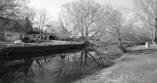
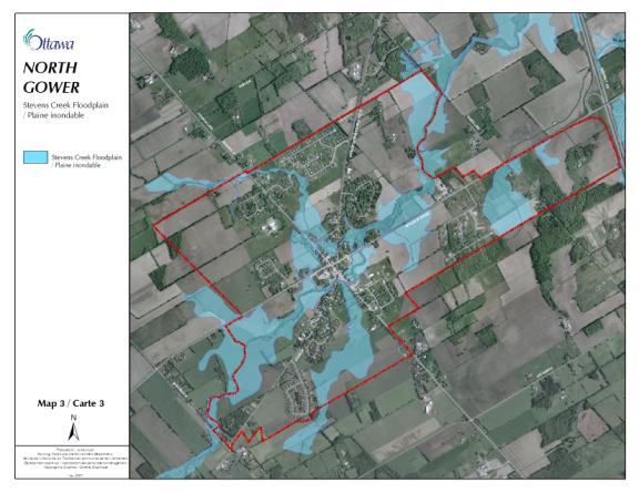
Stevens
Creek and Floodplain
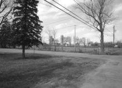
Stevens Creek and its flood plain contribute a great deal to the open, green character of North Gower, and are highly valued by area residents. Stevens Creek meanders through North Gower and the creek, its tributaries, the Taylor Municipal Drain and the Dillon-Wallace Drain, drain all land within the village. These agricultural drains have little riparian vegetation and both exhibit signs of erosion. The source of Stevens Creek is in the Marlborough Forest, a provincially significant wetland and natural environment area west of North Gower, and the creek discharges into the Rideau River at the village of Kars less than five kilometres to the east.
Stevens Creek ranges in width from five to 20 metres. The banks of the creek and parts of the surrounding floodplain are highly vegetated, with the flood plain ranging from 300 metres to over 600 metres in width (Gore and Storrie, 1995). In addition, Stevens Creek has unstable slopes, which have been identified in the Official Plan. The Rideau Valley Conservation Authority has updated the floodplain mapping, with the new mapping to be reflected in the new zoning for the village.
Water quality upstream of the village is good but it deteriorates as the creek passes through the village. Downstream, water quality is impaired due to elevated phosphorus and sediment levels, which may be attributed to surrounding clay soils, erosion due to removal of bank vegetation, and agricultural practices (City of Ottawa, 2004). It is not possible to determine the specific cause of water deterioration at this time with the information available.
A dam on Stevens Creek is in need of repair or removal. Construction of the dam may have blocked one spawning ground in the upper reaches of Stevens Creek, and several organizations have expressed interest in rehabilitating this area (C.Burns 2002). Residents have indicated that they wish to see the dam removed.
Apart from Stevens Creek, there are few natural areas in North Gower because most of the land is cultivated. Residents highly value a large, high-quality woodlot just outside the southern boundary of the village, which consists predominantly of native mature trees, shrubs and herbs (Gore and Storrie, 1995).
As a general approach, the Official Plan supports watershed and subwatershed planning as the basis for managing growth throughout the city. By identifying the natural features and functions of the watershed or subwatershed, the plans can propose measures to enhance these elements and set parameters for future development. The City and the conservation authorities set priority areas for watershed and subwatershed plans on the basis of such criteria as development pressure and condition of the natural environment.
The Rideau Valley Conservation Authority completed the Lower Rideau Watershed Strategy in fall 2005. The strategy applied an eco-system approach to develop a set of strategies for achieving multiple objectives in the management of the Lower Rideau River and its corridor, and updated the corresponding policies and procedures. Stevens Creek is a tributary to the Lower Rideau River, and as such, was considered in this study.
A subwatershed study of Stevens Creek would provide the best understanding of the role of Stevens Creek in the larger Rideau River watershed, the impact of existing and future land-use activities on the natural features and functions, and recommended measures to effectively address these impacts. The study would also refine the corridor setbacks for Stevens Creek and its tributaries, and ultimately set guidelines for managing stormwater. A subwatershed study would need to be consistent with the Lower Rideau Watershed Strategy.
 Until
a subwatershed study is undertaken, the environmental health of Stevens Creek
and its floodplain can be supported by:
Until
a subwatershed study is undertaken, the environmental health of Stevens Creek
and its floodplain can be supported by:
· Delineating the area to be zoned as floodplain, based on updated mapping by the Rideau Valley Conservation Authority
· Encouraging the restoration of the natural vegetation along the creek and tributaries to improve wildlife corridor function and water quality
· Ensuring that the presence of steep slopes along the creek is considered, through the development review process and private landowner stewardship
· Proposing interim guidelines for stormwater management in accordance with the Stormwater Management Practices Planning and Design Manual (MOE, 2003), pending completion of a subwatershed study
· Consulting the Lower Rideau Watershed Strategy in review of future planning applications
·
 Establishing
development setbacks/buffers in accordance with policies contained in Section
4.7.3 of the Official Plan
Establishing
development setbacks/buffers in accordance with policies contained in Section
4.7.3 of the Official Plan
Parks and Open Spaces
Stevens Creek is the backbone of an open space system that
residents would like to see developed to connect their homes with open spaces
and recreation facilities within and outside the village. A system of informal
pathways on privately owned land now provides much of this function, but public
access may be difficult to maintain as the village grows. The land within and
adjacent to Stevens Creek and its flood plain is privately owned and it will be
challenging to secure continuous public access through this area. In the future the City will secure public
access along the shoreline in accordance with Section 4.6.3 policy 2 of the
Official Plan.
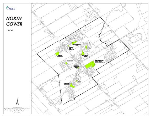
North Gower has a considerable number of private open spaces, large open areas under private ownership, and public parks (see Appendix 3). Parks are well situated throughout the village. New parks are typically created through the land subdivision process, which requires developers to provide five per cent of the land subject to the application or its cash value as parkland dedication. The parkland dedication requirements are under review.
 Public open
space in North Gower includes undeveloped parks and parks with basketball
courts, play structures and other equipment. Additional recreation areas are
located at the North Gower Public School and a municipally-owned bowling
alley.
Public open
space in North Gower includes undeveloped parks and parks with basketball
courts, play structures and other equipment. Additional recreation areas are
located at the North Gower Public School and a municipally-owned bowling
alley.
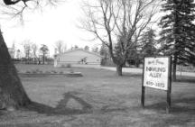
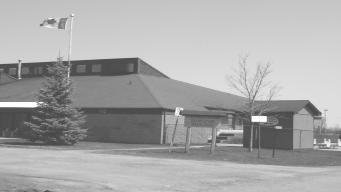
The Alfred Taylor Recreation Facility, built on a 16-acre site 20 years ago, is the focus of recreational activities. The centre includes a community hall, outdoor rink, baseball diamonds, a toddler playground, soccer pitches, a mountain for winter activities, and tennis courts. Various clubs, baseball leagues, and organizations for tournaments and fund-raising events extensively use the site.
This Recreation Facility has a building manager, although a volunteer recreation association (RA) manages its active and passive facilities under the terms of a facility service and maintenance agreement with the City of Ottawa. The RA provides a community-driven venue for residents of all age groups to develop and support outdoor and indoor recreation, and arts and cultural activities and programs. A master plan for the Alfred Taylor Recreation Facility was prepared in 1994 by Corush Sunderland Wright Limited.
 Cultural
open spaces in the village include the Horace Seabrook Park, the now-closed
Union Cemetery, the oldest in the village, and the Anglican Church cemetery
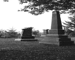
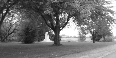
located on Church Street. A small cenotaph established by the residents of
North Gower is located within the Village Centre.
Cultural
open spaces in the village include the Horace Seabrook Park, the now-closed
Union Cemetery, the oldest in the village, and the Anglican Church cemetery
located on Church Street. A small cenotaph established by the residents of
North Gower is located within the Village Centre.
The Official Plan supports development of rural recreational pathways to provide both on-road and off-road networks for pedestrians and cyclists. North Gower residents participated in a rural pathway study in 2005.
A parks and open space system can be supported by:
· Undertaking a park and open space plan incorporating existing parks, open spaces, pathways and amenities as well as proposing a future network
· Identifying a conceptual multi-use pathway system within the parks and open space plan, to guide City staff in evaluation of development applications, such as subdivisions, so that these pathways can be implemented and become part of an overall public system over time
 Conserving
and Promoting Heritage Resources
Conserving
and Promoting Heritage Resources
North Gower residents appreciate the history of their community and would like to maintain and share their heritage with others. The Local Architectural Conservation Advisory Committee (LACAC) of the former Township of Rideau created an inventory of historic buildings in 1990. Some of these buildings are designated while others were of “interest” to LACAC. It is thought that the oldest surviving buildings date from about 1850 to 1870, and many are located along Church Street, Fourth Line Road and Roger Stevens Drive.
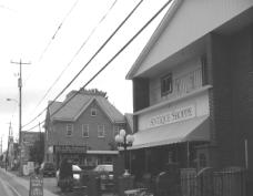
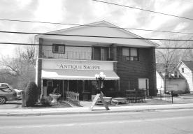
 Commercial buildings with
heritage value include Harrison's Garage on Fourth Line Road, the old
barns used by the Farmer's Market, and the former bank and tailor shop,
now rental apartments. The Boyd Block building material was used
extensively in the village and a list of 26 buildings constructed
from this material has been compiled. Other building materials that
characterize the village are "tin" roof shingles manufactured
by Mr. Hagan and Mr. Mathews in the village and clay brick from the North
Gower brick factory.
Commercial buildings with
heritage value include Harrison's Garage on Fourth Line Road, the old
barns used by the Farmer's Market, and the former bank and tailor shop,
now rental apartments. The Boyd Block building material was used
extensively in the village and a list of 26 buildings constructed
from this material has been compiled. Other building materials that
characterize the village are "tin" roof shingles manufactured
by Mr. Hagan and Mr. Mathews in the village and clay brick from the North
Gower brick factory.
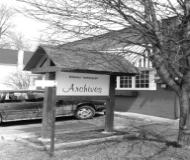 The
Rideau Archives Branch, City of Ottawa Archives, occupies the first township
hall, a heritage building (1876), modified to provide suitable archival storage
and display space. The Archives has preserved and made available historical
records, which document local communities, institutions, professions and
pioneer families in and around North Gower. As well, the Archives mounts
exhibitions on local historical themes using both its records and historical
artefacts from within the community.
The
Rideau Archives Branch, City of Ottawa Archives, occupies the first township
hall, a heritage building (1876), modified to provide suitable archival storage
and display space. The Archives has preserved and made available historical
records, which document local communities, institutions, professions and
pioneer families in and around North Gower. As well, the Archives mounts
exhibitions on local historical themes using both its records and historical
artefacts from within the community.
As of August 2005, the City’s Heritage Reference List identified six buildings that have been designated as heritage buildings and another 48 “listed” buildings, which are of architectural interest (see Appendix 2). Designated buildings undergoing alterations follow a process to ensure that proposed changes do not affect the heritage attributes of a building. Municipal grants are only available for designated heritage buildings to assist in their maintenance.
This Plan can help conserve and promote heritage resources by:
·
Identifying additional
buildings which are of heritage interest and adding these to Ottawa’s Heritage
Reference List
· Developing design guidelines for new and infill development within the Village Centre so that new buildings and additions are compatible with the existing character of the Village Centre
Building sense of community
 Residents’ sense of community draws on many sources,
some of which come from the village itself: its heritage, its lush rural
setting, views within and outside the boundaries. As the village grows, the
community design plan can provide a framework so that the village does not
become a collection of new subdivisions around an historic core. Since the
vacant land is now held in large blocks under single ownership, it is likely that
most growth will occur through subdivision, rather than by severance of
individual lots.
Residents’ sense of community draws on many sources,
some of which come from the village itself: its heritage, its lush rural
setting, views within and outside the boundaries. As the village grows, the
community design plan can provide a framework so that the village does not
become a collection of new subdivisions around an historic core. Since the
vacant land is now held in large blocks under single ownership, it is likely that
most growth will occur through subdivision, rather than by severance of
individual lots.
Residents’
sense of community can be supported through:
·
The creation of
residential subdivision guidelines appropriate for the village, that foster
safe pedestrian and road connections among communities, preserve open space
views, and provide opportunities for residents to meet in attractive public
spaces
|
Goal: To ensure that village residents’ safety
and security is provided for and
that there is adequate infrastructure services to permit growth. |
An alternative, less desirable approach, would be a scoped
‘reach study’ of Stevens Creek downstream of the village. Since North Gower is
located near the downstream end of the subwatershed, the impact of village
development could be limited to a relatively short downstream reach. This study
would still require appropriate
modeling efforts to confirm stormwater management (SWM) criteria (quality,
quantity, erosion, water balance, etc.) and to confirm overall development
limits (setbacks from watercourses, etc.).
Such a scoped approach, completed for the whole village (rather than on
a development-by-development basis) and on a reach basis (i.e., assessing
impacts downstream to the confluence with the Rideau River), would represent an
acceptable interim approach in the absence of a subwatershed study. Subject to
the extent (area) of development proceeding, and in consultation with the Conservation
Authority, the scoped “reach study” may be requested of future development
proponent(s).
A reach study of Stevens Creek and a subwatershed study will be prioritized among other such projects for future action by the City. As an interim approach, stormwater management guidelines are proposed.
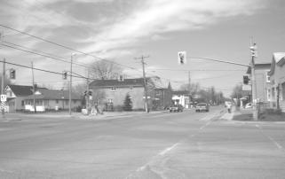
There are three arterial roadways (Prince of Wales Drive, Fourth Line Road, Roger Stevens Drive) and two collector roads (Church Street and Third Line Road) in North Gower. No new arterial or collector roads have been proposed for the village. On-street parking is allowed and some businesses have their own parking lots; however, several residents would like the city to develop municipal parking facilities in the Village Centre.
Fourth Line Road (Prince of Wales Drive to Shellstar Drive) and Roger Stevens Drive were resurfaced recently. Two bridge rehabilitations occurred in 2005: at the north end of Fourth Line Road and on Roger Stevens Drive just east of the traffic light.
In general, sidewalks are available in most parts of the historic village and along the main streets, but not within new residential neighbourhoods, where they are not typically required. Sidewalks are built to varying standards, some being traditional poured concrete sidewalks with curbs and others being multi-purpose asphalt walks without curbs. See Appendix 4 for a detailed sidewalk inventory.
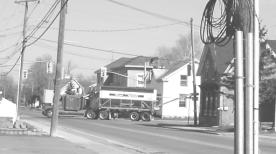 There are some concerns about truck
traffic traveling on Roger Stevens Drive through the centre of the North Gower.
Concerns are focused on the amount of traffic and the vibrations caused by
heavy vehicles that is felt in houses. A suggestion was to divert the truck
traffic from entering their village.
The amount of traffic on Church Street is also a concern and a
suggestion to redirect through traffic to Roger Stevens and McCordick Road has
been put forward. One last concern focuses on traffic on Prince of Wales Drive,
James Craig Street and Andrew Street.
There are some concerns about truck
traffic traveling on Roger Stevens Drive through the centre of the North Gower.
Concerns are focused on the amount of traffic and the vibrations caused by
heavy vehicles that is felt in houses. A suggestion was to divert the truck
traffic from entering their village.
The amount of traffic on Church Street is also a concern and a
suggestion to redirect through traffic to Roger Stevens and McCordick Road has
been put forward. One last concern focuses on traffic on Prince of Wales Drive,
James Craig Street and Andrew Street.
These
traffic-related concerns have been conveyed to Public Works and Services staff
and the Design Group has now been provided with a method to follow-up these
specific concerns.
Bus service (# 45 Rideau) in North Gower is provided to downtown during peak hours only. A special Friday-only service is also provided to Carlingwood Shopping Centre for residents, particularly seniors. In addition, a park-n-ride facility at the North Gower Client Services Centre is provided. It is advertised on the web, but is not signed.
The Design Group acknowledge that Transit Services are notified of proposed development areas. However, they would like their transit services to be improved also on an as-warranted basis. One idea suggested by the Design Group is a park and ride service for the outlying villages so that they could quickly travel by bus into the urban area.
Utilities are overhead in the Village Centre but buried within new residential subdivisions. Some residents would like utilities to be buried within the Village Centre as well. Burial of hydro wires and other utilities is a costly venture that is sometimes undertaken with a local business improvement area in the urban area. Burial of utilities is desired by the Design Group and they would like this proposal to be revisited in the future.
Streetlighting is a concern of the Design Group. They would like to see upgraded streetlights
in existing subdivisions for the safety and security of residents, and they are
concerned about the adequacy
of existing street lighting along sections of certain streets such as Prince of
Wales, Roger Stevens Drive and Fourth Line Road. They would also like to see
lighting throughout new subdivisions and not just at intersections. Better lighting of the bridges in the James
Craig Street, Andrew Street and Prince of Wales Drive area, heritage lighting
in the centre of the village and pathway lighting is also desired by the Design
Group. There is a project being undertaken in the Planning, Transportation and
the Environment department to review policies and standards related to lighting
within the road right-of-way. The project was completed in 2007.
 Fire
and Police
Fire
and Police
There is a local volunteer fire staff with one rescue pumper, one tanker, one rescue truck and one brush truck with ATV trailer. There is a single water storage tank located in Horace Seabrook Park. During 2005, the fire station on Roger Stevens Drive was expanded to provide additional meeting space and added additional water storage tanks. The Design Group proposes that potential water locations can be found in the vicinity of the North Gower Marlborough Public School (south of Stevens Creek bridge off Fourth Line Road) and at the North Gower Bowling Alley. Police coverage is provided by the Ottawa Police.
Details of the Amendment
The following changes are hereby made to the Official Plan for the City of Ottawa:
i) The Official Plan for the City of Ottawa, Volume 2C is hereby amended by adding the North Gower Secondary Plan as follows:
North Gower Secondary Plan
1.0 Introduction
The North Gower Secondary Plan is a guide for the long-term orderly development of the Village of North Gower taking into account its unique rural setting. A community vision, which resulted in goals and objectives, provides a framework for change. The Secondary Plan provides specific direction on land-use, a parks and open space system, a multi-use pathway system, village centre and future roads.
This Secondary Plan represents a collaborative planning effort to develop the village as a desirable place to live, work and shop.
2.0
Planning Area
3.0
Vision, Goals and Objectives
The vision statements below describe the type of village desired by residents in the future.
3.1 Vision
“Based on
its strong roots in agriculture, North Gower continues to thrive as the social
heart of a vibrant farming community, where people put down deep roots and
families live for generations surrounded by a legacy of unique heritage
buildings. Over the years, the village has grown slowly, embracing its
newcomers and welcoming them into the community, without forgetting its long
history. In many ways, this growth has allowed the young people of the village
to stay close to home while seeking opportunities in and beyond the family
farm. Residents of the village and the surrounding farms have worked together
for more than a century and a half to create a centre which responds to the
needs of both residents and visitors.
There is a nurturing, welcoming attitude in the community that encourages
families to settle and raise their children here, and grandparents enjoy living
comfortably while they watch their children and grandchildren grow and enjoy a
full, yet independent, lifestyle in the community. Young adults are able to
find affordable housing and recreation within easy reach of employment, and
youth are provided with opportunities for recreation and growth, which fosters
the continuation of this sense of community.
The business community in the village has regained ground lost in the past, and
again thrives as in the "old days". North Gower is a village of
unique recent entrepreneurs as well as long-established, widely respected
businesses. Shops and professional offices, in new and heritage buildings in
the commercial and core districts of the village, provide goods and services
required for day-to-day living and farming. The Farmer’s Market celebrates a
decades-long history by welcoming new vendors and regular visitors every year.
The arts and gardening communities thrive on their garden shows, studio/open
houses/workshops that have become a regular part of our village life.
Village residents live relaxed, but active, lives. Recreational and community
activities are the fundamental avenue where old friends meet and newcomers to
the village make acquaintances and form friendships that last a lifetime. The
Community Centre and surrounding grounds are the envy of other communities,
forming as they do the “heart of the village” connecting residential and
commercial neighbourhoods with multi-purpose pathways through parklands and
green space. A youth centre provides a meeting place for the village’s young
people to gather and meet friends, enjoy recreational activities, learn new
skills and share music or stories in a safe environment.
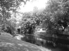
Green spaces, allocated when early subdivisions were built, form the core of a system of parks and reserved lands that are now developed parklands connected by walking and cycling paths. The gem of this network is the Stevens Creek Green, with its picturesque bridges, which extends along the shores of Stevens Creek throughout its length in the village and provides an enviable natural environment where residents enjoy a variety of cultural and recreational activities.
3.2 Goals and Objectives
The following goals and objectives provide further direction regarding a plan for North Gower.
|
GOALS AND OBJECTIVES Growth Management
Goal:
To manage growth in North Gower in an orderly way that fosters economic opportunities while
providing for a mix of housing for residents recognizing
its rural setting. Objectives: ·
To protect and enhance commercial functions in the
Village Centre · To provide adequate opportunity for employment · To provide a variety of business to support the day to day needs of residents and visitors and surrounding farming community · To create a venue that is attractive and interesting for visitors, building on attributes of the village ·
To provide an adequate mix of housing, including
affordable housing, for current and
future needs of residents ·
To
attract and provide support for the rural/farm community Village Character
Goal: To preserve and enhance
the village’s natural features, historic character, open spaces and amenities in order to build
upon residents’ sense of community. Objectives: · To ensure new development is compatible with the existing look and feel of the village’s oldest streets located within the core and its existing village character · To recognize significant landforms · To design with nature · To preserve the riparian zone adjacent to Stevens Creek and improve public access to the creek corridor · To identify a safe and convenient multi-use pathway system that links open spaces and recreational resources and land-uses · To conserve and to promote North Gower’s cultural and architectural heritage resources Public Services
Goal:
To ensure that village residents’ safety and security is provided for
and that there is adequate
infrastructure services to permit growth.
Objectives: · To provide adequate lighting levels (streetlights) · To ensure safe water and wastewater disposal systems · To provide recreational and leisure facilities that are convenient to residents · To identify partnerships for ongoing management for these recreational and leisure facilities · To provide state of the art accessibility to communications · To ensure safe vehicular traffic flow within the village · To provide adequate fire services · To ensure a system of sidewalks and pathways to encourage pedestrian activity ·
To protect existing development and to protect the
floodplain from inappropriate
development in the vicinity of the Stevens Creek floodplain |
Heritage
Residential Design Guidelines
The following design guidelines have been developed to encourage development that is compatible with the character of the streetscape:
1) Driveways to the side of the house and garages to the rear of the property are encouraged.
2) The garage or other outbuildings should be simply finished and have gable or gambrel roofs.
3) Landscape features, such as informal hedges along property lines, mass plantings of perennials and the use of large tree species, are encouraged.
4) Planting large tree species just within the front property line, but away from overhead lines, is encouraged. This will help to preserve the shade and visual amenity provided by the tree canopy of large street trees.
5) House forms such as the symmetrical 1 ½ or 2 storey, side gable roof, or the 2 storey, front gable roof, or the 2 storey house with multiple gables and bays are encouraged.
6) Porches at the front of the house with shed roofs are encouraged.
7) Adequate landscaping should be provided in order to preserve the subordinate relationship of the house to the landscape in the streetscape.
8) The design of infill development should be compatible with the proportions, roof design and the site plan of the existing buildings in the streetscape.
9) The use of simulated heritage detailing and decoration is discouraged.
10) Designers are encouraged to use contemporary materials and to use contemporary methods of architectural expression. New buildings should be of their own time.
Heritage
Commercial Design Guidelines
The following design guidelines have been developed to encourage development that is compatible with the character of the streetscape:
1) Adaptive-use of existing farm and commercial buildings is encouraged.
2) Retention of early signage is encouraged.
3) Projecting or bracketed signs are encouraged. Backlit signs are discouraged. Exterior lights may be used to illuminate signs at night.
4) Thick plantings of informal hedges and wide side yards are encouraged as a buffer between commercial and residential use.
5) Porches with shed roofs or shed roof awnings are encouraged.
6) Large garage-type doors, functioning as loading bays for example, are encouraged.
7) Domestic building forms for commercial uses on Fourth Line are encouraged. Refer to the three building forms identified in the residential use guidelines.
8) Designers are encouraged to use contemporary materials and to use contemporary methods of architectural expression. New buildings should be of their own time.
1. Environmental Constraints: As noted in Appendix A of the MOE SWM Planning and Design Manual: Good planning integrates the design of a site and the design of the stormwater management facilities in one process. In conjunction with assessing the SWM approach for the site, environmental and natural hazard constraints should be mapped on the site plan to determine the limits of development. Requirements for this exercise are detailed in the MOE Manual, the City’s Official Plan (Section 4) and other detailed guidance documents.
2. SWM Design Criteria: SWM design
criteria must be developed on a site-specific basis
to address changes to water balance, water quality and water quantity resulting
from the proposed development. However, subject to the approved minimum lot
sizes (as per detailed hydrogeological studies), the preferred emphasis will be
on site design measures and lot level and conveyance controls to achieve the
required SWM objectives. (Site design measures refer to ‘low impact
development’ methods such as reducing the extent of clearing/grading;
maximizing overland sheet flow; increasing site and lot vegetation cover, etc.)
2.1 Water Balance: A water balance exercise should be completed to assess the post-development change in runoff volume. The initial target should be to match the pre-development runoff volume by applying appropriate site design measures, and lot level and conveyance controls.
2.2 Water Quantity: Subject to adequate demonstration that pre-development runoff volumes cannot reasonably be achieved via site design measures, lot level, and conveyance controls, the need for water quantity control (erosion and two to 100 year flood flow impacts) must be assessed. This will include a characterization of the ability of Stevens Creek to adequately convey any increase in peak flows and runoff volumes resulting from the development. This characterization will extend for a sufficient distance downstream of the site such that potential impacts from the site become negligible. After maximizing the use of site design measures, lot level and conveyance controls, should the increase in peak flows or runoff volumes from the development result in unacceptable impacts, or the existing capacity of the receiver is insufficient, the proponent will recommend measures to mitigate this impact on-site through appropriate SWM practices.
3.3 Water Quality: Every effort will be made to achieve water quality design criteria through the use of site design measures, lot level controls and conveyance controls before proposing end-of-pipe facilities.
8.4 Transit
Additional
transit service should be extended to North Gower as the village evolves and
demand warrants it.
8.5 Traffic, Parking and Utilities
As the Village Centre commercial area matures and there is a
demonstrated need for the parking measures, public parking lots will be
considered.
9.0
Implementation
The North
Gower Secondary Plan is a land-use planning policy document that will guide
future development using planning tools provided by the Planning Act. Many
elements shown in the Plan are conceptual including location of parks,
multi-use pathway locations, and boundaries of land-use designations.
Modifications are anticipated in implementing the Plan as long as the general
intent of the Plan is maintained.
Interpretation
Section
The
land-use plan is a statement of land-use planning policy that will be used to
guide the development and the long-term growth of North Gower. Precise
boundaries for the land-uses will be set out in the Zoning By-law. The land-use plan will provide direction in
the preparation of development proposals by developers and will be used by City
staff in reviewing applications such as subdivision, rezoning and site plan
control.
The North
Gower Community Design Plan approved by City Council on January 23, 2008
provides the basis for this Secondary Plan and should be consulted for
background purposes.
Any changes
to the North Gower Secondary Plan will require an Official Plan Amendment and
City Council approval.
Amendments
to the North Gower Secondary Plan will not be required for zoning amendments to
permit residential uses other than detached dwellings.
Implementation
Strategy
Recommendations
of the North Gower Secondary Plan are implemented primarily through planning
tools such as zoning by-laws, subdivision, and site plan control. Residents,
business people and the Design Group will help implement the Plan through their
participation in development review and through other means identified in the
Plan.
Listed
below are distinct action items with responsibilities categorized by theme:
land-use, parks, open space and multi-use pathway, village centre plan,
economic development Stevens Creek, servicing and public services.
|
NORTH GOWER SECONDARY PLAN Implementation Strategy |
||
|
Recommendation |
Responsible |
Timeframe |
|
Land-use |
|
|
|
City
Council |
2007 |
|
|
2. Approve Official Plan Amendments: i)
to expand village boundaries, ii)
to remove North Gower Village Plan replacing it with the
North Gower Community Design Plan iii) to incorporate the North Gower Community Design Plan in the
Official Plan as a
Secondary Plan |
||
|
Planning,
Transit and the Environment Department |
2007/08 |
|
|
Planning,
Transit and the Environment Department |
On-going |
|
|
|
|
|
|
Parks
and Open Space Plan/ Multi-use
Pathway Plan |
|
|
|
Planning,
Transit and the Environment Department Community
and Protective Services Department |
On-going |
|
|
Residents Community
and Protective Services Department |
On-going |
|
|
Residents Community
and Protective Services Department |
On-going |
|
|
Planning,
Transit and the Environment Department |
2007 |
|
|
Community
and Protective Services |
2008 |
|
|
|
|
|
|
Village Centre,
Heritage and Design |
|
|
|
1. Implement
Heritage Residential and Commercial Design
Guidelines through development applications |
Planning,
Transit and the Environment Department Property
owners |
On-going |
|
2. i) Implement
streetscape improvement recommendations, including
sandwich board issue |
On-going |
|
|
3. Implement village landmark and gateway
policies during development
approvals process |
Planning,
Transit and the Environment Department |
On-going |
|
4. Investigate placement of an information kiosk for Village Centre |
Residents |
2007 |
|
|
|
|
|
Economic Development |
|
|
|
1. Initiate work to market and attract
businesses to North Gower |
Business
owners Residents |
On-going |
|
|
|
|
|
Stevens
Creek |
|
|
|
Planning,
Transit and the Environment Department Rideau
Valley Conservation Authority Property
Owners |
On-going |
|
|
Planning,
Transit and the Environment Department |
2007 |
|
|
Planning,
Transit and the Environment Department |
On-going |
|
|
|
|
|
|
Servicing |
|
|
|
Planning,
Transit and the Environment Department |
On-going |
|
|
Planning,
Transit and the Environment Department |
2007/2008 |
|
|
|
|
|
|
Public
Services |
|
|
|
1. Investigate the traffic-related
requests to determine appropriate
follow-up action and implement as deemed
appropriate |
Public
Works and Services |
2007 |
9.1
Monitoring
Monitoring
the North Gower Secondary Plan will indicate whether the recommendations are
being carried out as intended. Should
there be any changes to the North Gower Secondary Plan, amendments will be
necessary.
The North Gower residents and the City should monitor the
performance of this plan to assess whether the recommendations have been
carried out and resulted in the intended effect.
Map 1 2000 Land-use
Map 2 Proposed Boundary Expansion
Map 3 Stevens Creek Floodplain
Appendix 1 Farming Practices in North Gower
Appendix 2 Heritage Reference List and Designated
Buildings in North Gower
Appendix 4 North Gower Sidewalk and Storm Sewer
Inventory
APPENDIX 1
|
Farming Practices in North Gower (Source: Design Group 2006) |
|
|
|
|
|
Dairy cattle and port or cash crops |
Droogh Farm, Fourth Line Road Seabrook Farm, Church Street |
|
Beef cattle, chickens and cash crops |
Cowell Farm, Fourth Line Road |
|
Cash crops (e.g. cattle corn, soy bean, wheat, barley, alfalfa & timothy hay) |
Freeman Farm, Fourth Line Road McEwen Farm, Prince of Wales Drive Pratt Farm, Third Line Road Seabrook Farm, Roger Stevens Drive Stratton Farm, Prince of Wales Drive Williams Farm, Roger Stevens Drive |
|
Riding horses |
Craig House Farm, Craig Street Quantum Farm, Third Line Road |
|
Strawberries, raspberries, pumpkins |
Sharway Berry Farm, Prince of Wales Drive |
|
Market garden produce |
Cava’s Organic Farm, Roger Stevens Drive Colonial Fruit Farm, Prince of Wales Rideau Pine Farms, Fourth Line Road |
|
|
|
This information represents an inventory of potential heritage resources as carried out in the former Rideau Township. “IV” indicates those buildings that have been designated through Part IV of the Heritage Act.
|
1,125 |
|
CHURCH |
ST |
|
Listed |
|
|||||
|
2,332 |
|
CHURCH |
ST |
|
Listed |
|
|||||
|
2,334 |
|
CHURCH |
ST |
|
Listed |
|
|||||
|
2,340 |
|
CHURCH |
ST |
|
Listed |
|
|||||
|
2,343 |
|
CHURCH |
ST |
|
Listed |
|
|||||
|
2,347 |
|
CHURCH |
ST |
|
Listed |
|
|||||
|
2,352 |
|
CHURCH |
ST |
|
Listed |
|
|||||
|
2,359 |
|
CHURCH |
ST |
|
Listed |
|
|||||
|
2,367 |
|
CHURCH |
ST |
|
Listed |
|
|||||
|
2,368 |
|
CHURCH |
ST |
|
Listed |
|
|||||
|
2,371 |
|
CHURCH |
ST |
|
Listed |
|
|||||
|
2,372 |
|
CHURCH |
ST |
|
Listed |
|
|||||
|
2,376 |
|
CHURCH |
ST |
|
Listed |
|
|||||
|
2,377 |
|
CHURCH |
ST |
|
Listed |
|
|||||
|
2,378 |
|
CHURCH |
ST |
|
Listed |
|
|||||
|
2,381 |
|
CHURCH |
ST |
|
Listed |
|
|||||
|
2,391 |
|
CHURCH |
ST |
|
Listed |
|
|||||
|
6,295 |
|
FOURTH
LINE |
RD |
IV |
Listed |
|
|
|||
|
6,463 |
|
FOURTH
LINE |
RD |
|
Listed |
|
|
|||
|
6,472 |
|
FOURTH
LINE |
RD |
|
Listed |
|
|
|||
|
6,475 |
|
FOURTH
LINE |
RD |
|
Listed |
|
|
|||
|
6,566 |
|
FOURTH
LINE |
RD |
|
Listed |
|
|
|||
|
6,576 |
|
FOURTH
LINE |
RD |
IV |
Listed |
|
|
|||
|
6,581 |
|
FOURTH
LINE |
RD |
IV |
Listed |
|
|
|||
|
6,583 |
|
FOURTH
LINE |
RD |
|
Listed |
|
|
|||
|
6,584 |
|
FOURTH
LINE |
RD |
|
Listed |
|
|
|||
|
6,586 |
|
FOURTH
LINE |
RD |
|
Listed |
|
|
|||
|
6,593 |
|
FOURTH
LINE |
RD |
|
Listed |
|
|
|||
|
6,594 |
|
FOURTH
LINE |
RD |
|
Listed |
|
|
|||
|
6,599 |
|
FOURTH
LINE |
RD |
|
Listed |
|
|
|||
|
6,606 |
|
FOURTH
LINE |
RD |
|
Listed |
|
|
|||
|
6,607 |
|
FOURTH
LINE |
RD |
IV |
Listed |
|
|
|||
|
6,608 |
|
FOURTH
LINE |
RD |
|
Listed |
|
|
|||
|
6,609 |
|
FOURTH
LINE |
RD |
|
Listed |
|
|
|||
|
6,613 |
|
FOURTH
LINE |
RD |
|
Listed |
|
|
|||
|
6,617 |
|
FOURTH
LINE |
RD |
|
Listed |
|
|
|||
|
6,624 |
|
FOURTH
LINE |
RD |
|
Listed |
|
|
|||
|
6,652 |
|
FOURTH
LINE |
RD |
|
Listed |
|
|
|||
|
6,673 |
|
FOURTH
LINE |
RD |
|
Listed |
|
|
|||
|
6,897 |
|
FOURTH
LINE |
RD |
|
Listed |
|
|
|||
|
6,981 |
|
FOURTH
LINE |
RD |
|
|
|
|
|||
|
2,300 |
|
JAMES CRAIG |
ST |
|
Listed |
|
|
|||
|
2,273 |
|
ROGER
STEVENS |
DR |
|
Listed |
|
|
|||
|
2,310 |
|
ROGER
STEVENS |
DR |
|
Listed |
|
|
|||
|
2,313 |
|
ROGER
STEVENS |
DR |
|
Listed |
|
|
|||
|
2,320 |
|
ROGER
STEVENS |
DR |
|
Listed |
|
|
|||
|
2,323 |
|
ROGER
STEVENS |
DR |
IV |
Listed |
|
|
|||
|
2,333 |
|
ROGER
STEVENS |
DR |
|
Listed |
|
|
|||
|
2,335 |
|
ROGER
STEVENS |
DR |
|
Listed |
|
|
|||
|
2,337 |
|
ROGER
STEVENS |
DR |
|
Listed |
|
|
|||
|
2,341 |
|
ROGER
STEVENS |
DR |
|
Listed |
|
|
|||
|
2,352 |
|
ROGER
STEVENS |
DR |
|
Listed |
|
|
|||
|
2,407 |
|
ROGER
STEVENS |
DR |
|
Listed |
|
|
|||
|
2,659 |
|
ROGER
STEVENS |
DR |
IV |
Listed |
|
|
|||
Municipal Park Inventory |
|
|
Developed parks with facilities |
Parks (grass only) |
|
Alfred Taylor Recreation Centre 6.3 ha (15.6 ac) |
Craighurst Drive Park .5 ha (1.2 ac) |
|
Meadowbrook Park 1.1 ha ( 2.8 ac) |
Shell Star 1 Park 1.3 ha (3.2 ac) |
|
Horace Seabrook Park .2 ha(.5 ac) |
Lenida Drive Park .2 ha (.6 ac) |
|
Edward Kidd Park .2 ha (5 ac) |
Russvern Park .8 ha (2 ac) |
|
Cenotaph Park .01 ha (.02 ac) |
Farmstead Park |
|
Four Corners Park .008 ha (.02 ac) |
|
|
Edward Craig Park 1.7 ha (4.1 ac) |
|
|
Bowling Alley |
|
APPENDIX 4
In general, sidewalks are available in most parts of the historic village and along the main streets, but not in the newer residential neighbourhoods. Sidewalks are built to varying standards, some being traditional poured concrete sidewalks with curbs and others being multi-purpose asphalt walks without curbs, and are presently in various states of repair (or disrepair) being largely ignored in recent years.
• From Main Street on Roger Stevens East, sidewalks go as far as 2311 on the north side (just before Co-op). On the south side, the sidewalk ends at 2320 and the storm sewer ends at 2316.
• From Main Street on Roger Stevens West, on the north side, sidewalk and storm sewer ends at 2363. On the south side, the sidewalk ends at Perkins Lumber. There is no sidewalk between Perkins Lumber and Centennial Town Hall.
• On Perkins Drive, from Roger Stevens, there is a sidewalk and storm sewer on the north and east sides. On the south and west sides of Perkins Drive, there is open ditch and creek for drainage.
• From Fourth Line Road on Church Street, there is a sidewalk and storm sewer on the north side to North Gower-Marlborough Public School. On the south side from Lenida Street east on Church Street, there is a sidewalk and storm sewer to Lenida Street west on Church Street.
• Carolin Court has no sidewalks and uses sub-drainage.
• On Main Street south from Roger Stevens, there are sidewalks and storm sewers to 6683 (Royal Bank) on the east side. On the west side, there are sidewalks to the old MTO lot.
• On Main Street north, there are sidewalks and storm sewers to Prince of Wales. From Prince of Wales and Main Street to the bowling alley, there is a sidewalk and storm sewer on the west side. Prince of Wales from Main Street to James Craig Street, there is a sidewalk and storm sewer on the south side. From James Craig Street there is a storm sewer and sidewalk on the east side for a short distance, but not as far as Michelangelo Court. On the west side, there is open drain to just north of the Cornerstone Wesleyan Church.
• On James Craig Street, there is a storm sewer but no sidewalk except from Andrew Street to Roger Stevens Drive on the west side.
• Community Way has no sidewalks but has sub-drains and open ditches.
• Willisbrook Drive has no sidewalks and uses open ditches.
• Recreational pathways (asphalt) link Meadowbrook subdivision to Edward Kidd Crescent and James Craig Street to Michelangelo Court.
• Unofficial paths on private property, but widely used by village residents, link Fourth Line Road to Union Cemetery and Craighurst Drive, and Maple Forest Estates to the Alfred Taylor Recreation Facility. Both of these are unmaintained dirt tracks made available for public use by the generosity of private landowners.
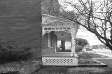
Residential
Characteristics
Within the Village Centre, the streetscape in older residential areas has an informal character. Several factors combine to create the informal village character. Large lots with wide frontage allow for a driveway to the side of the house and a separate garage to the rear of the property. The typical site plan of residential lots displays evidence of the early multiple uses that were accommodated on a single lot, such as small barns, outbuildings and sheds. Landscaping features that are typical include informal hedges between properties, large trees such as spruce, pine and maple along the perimeter of the lot, and informal plantings of shrubs and perennials throughout the property. The house is subordinate to the landscape because of the size of the lot relative to the house and because of the visual impact of the mature vegetation.
The house is
subordinate to the landscape
This area
features a mix of late 19th and early 20th century
classically inspired, Gothic Revival-inspired or Queen Anne Revival-inspired
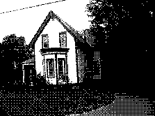
houses. The classically inspired, side gable, 1 ½ storey house is symmetrical,
generally horizontal in its proportions and has a gable centrally located over
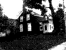
the front door. The Gothic Revival, front gable, two-storey house is generally
vertical in its proportions and has a steeply pitched roof. The Queen Anne
Revival house is 2 ½ storeys in height and has a complicated roofline with
multiple gables and bays. Porches with shed roofs are common to each of these building
types.
Classically
inspired, side gable Gothic Revival-inspired, front
gable
Queen Anne Revival- inspired, complicated
roofline
Commercial Characteristics
Building types in heritage commercial areas have two general forms. The first is the domestic building form that has been adapted to commercial use, and is common on the Fourth Line north of Roger Stevens Drive. The second is the flat–roofed, usually one-storey building form. These flat-roofed buildings usually feature a decorative cornice or parapet. The architecture and site plan of both of these building forms reflect the late 19th century origins of the community; the buildings are close to the road, have a wide frontage, the driveways are to the side of the building and outbuildings are to the rear. Commercial use is frequently directly adjacent to residential use. Informal hedges provide a visual screen between uses. Porches with shed roofs are common in both of the above forms; the shed roof may function as an awning. Gravel parking lots are typical and contribute to the informal character of the typical commercial use building.
APPENDIX 6
Description of Village Centre and Proposals (prepared by Design Group as part of 2004 community plan)
The
Village Centre
General Description
The Village Centre contains North Gower’s historic settlement, with many of its original houses still intact. It also encompasses historic Church Street and beautiful Perkins Drive along the shores of Stevens Creek. It is the Village Centre that most demonstrates North Gower’s unique character and heritage; it defines the village for its inhabitants and visitors alike, and shapes its identity. Growth of the village has tended to spread outward from the centre along the main roads in all directions, but development in vacant lands within the village has occurred to fill gaps in the village landscape in recent years. The Village Centre remains its social and commercial focus, fostering a vibrant village life both in the Centre and beyond.
Within the Village Centre several distinct areas may be identified each with its own character and design, all located geographically within the Centre but each contributing its own flavour to the whole. Collectively, they provide the village and its residents with the services and amenities needed to sustain day-to-day living and commercial operations. These areas are comprised of:
Fourth Line Road
Roger Stevens Drive
Church Street
Perkins Drive
Andrew Street, James Craig Street & Prince of Wales Drive
Community Way and the Alfred Taylor Recreation Facility
Within the Centre may be found the diversity of small-scale commercial activities, recreational facilities and mixed housing that defines North Gower as a vibrant rural community.
Objectives
The overall objective is to reinforce the separate and distinct functions of each of the areas of the Village Centre while building strong links between them and contributing a strong focus and sense of community.
The Village Centre should provide a unique identity for the village. It is the community’s gathering place, its social core, its commercial heart and the foundation of the village’s past, present and future.
Proposals
To: Enhance the visual impact of the area by modifications to the streetscape, which include placing services underground, improving sidewalks, and enhancing street planting and signage in a way which creates a consolidated character to the Village Centre;
· Encourage development of small businesses within the Village Centre and multi-purpose usage of existing or new buildings
· Encourage upkeep and enhancement of existing properties that have been designated through Part IV of the Ontario Heritage Act, by providing matching grants to property owners
· Provide secure and convenient parking facilities throughout the core while facilitating and promoting safe pedestrian access, when there is a demonstrated need for these facilities or when opportunities arise for acquiring properties
· Facilitate development of multi-purpose, and multi-family residential units within the Village Centre
· Restore existing natural resources and develop parklands and a network of pedestrian routes both within the Village Centre and between the Centre and the remainder of the village.
Fourth Line
Road North
General Description
This area is mainly a commercial district, mixed with private residences, some multiple-family housing and some public buildings. Businesses currently operating along this end of Fourth Line Road include hair salons, a restaurant, an auto service center, and an antique store; public buildings include the North Gower Branch of the Ottawa Public Library which is situated in the former township fire hall, the Rideau Archives housed in the former Town Hall, and the North Gower Bowling Alley. Historically, this was the main street and business sector for North Gower, but then and now, still has several residential buildings, making it a quaint balance of both. This area serves both incoming and outgoing traffic south towards Kemptville and north towards Richmond and Ottawa.
Objectives
This area is the village heart or center of the village. Visitors to the village form their opinions and memories of North Gower on the basis of their first impressions along this street. The long-term objectives for this area is to improve its visual impact and develop its potential as the “main street” in town, re-enforcing its heritage character and building on the strengths of the current streetscape.
Proposals
To:
· Encourage upkeep or improvement of existing buildings and landscapes in keeping with the heritage character of the older homes already present on the street.
· Re-develop the street to introduce landscaping features such as heritage lamp posts, hanging flower baskets in the summer, and seasonal flags or other decorative items at other times
· The street should be reconstructed to install underground wiring and services, re-design and re-surface sidewalks to encourage pedestrian use of the street; increased vegetation and tree planting, and signage directing visitors and locals to the Information Kiosk at the Bridge Street bridge.
· Encourage commercial development, multi-use buildings that provide housing and business opportunities, and provide off-street public parking, when required.
· Develop a multi-use pedestrian/cycle pathway along the footpath which currently runs across private land from the flashing light on Fourth Line to the Union Cemetery.
Fourth Line
Road South
General Description
The southern corridor of the village extends less than one kilometre from the Village Centre. This area extends from the village’s only traffic light, intersects with historic Church Street at the United Church, includes a bridge that crosses historic Stevens Creek and then intersects Community Way which leads to the village’s major recreation area. Beyond this area are working livestock and grain farms. The community has supported a mix of light and heavy commercial enterprises in this area which include: a funeral home, automotive (sales/repair/gas) and heavy farm mechanical industries, a welding shop, variety store and gas station, hair stylists, a home-based renovation enterprise and a wine/beer making store. Intermingled with these businesses are residential homes including two pre-Confederation homesteads.
Objectives
This area has the capacity to support many small businesses (craft/flower shop, tea room, home-based businesses etc.) within walking distance of the Village Centre. The objective in this neighbourhood is to provide a multitude of services and amenities to meet the needs of all residents in the village, linking the Community Centre to adjacent residential neighbourhoods and the Village Centre by a network of pedestrian walkways.
This section of the Fourth Line Road also carries considerable heavy vehicular traffic en route to/from highway 416 and requires significant traffic route changes and signage to make it safe for pedestrians and visitors. An information kiosk sign (“?”) will direct visitors to an appropriate location to advertise the services available in and around the village.
Proposals
To ensure:
§
Re-development studies and
consultations with the community are undertaken for development proposals
· Appropriate signage directing visitors to a proposed Information Kiosk in the Village Centre
· Undertake traffic study (cars and trucks) along Fourth Line Road to assess current traffic situation to respond to residents’ concerns
· Safe pedestrian passage and linkages to the Village Centre and the Alfred Taylor Recreation Facility site
· Develop multi-use pedestrian/cycle pathways to connect to a village-wide system
Roger Stevens Drive East
General Description
The character area is the main arterial route from the Village Centre to the major four-lane highway (416) to the east of the village. The dominant use of this area is single family residential with two duplex residences. Small lot sizes (all residences on the north side of the street encroach on road allowance), excessive large truck traffic and infrastructure insufficiencies (e.g., storm sewers) are major constraints to the development of the area.
Objectives
The long term objectives for this area is to develop Roger Stevens Drive East as a people-friendly mixed residential and commercial use area and the main entrance route to the village from Highway 416. Potential commercial uses, such as an art gallery, bed and breakfast accommodation, flower shop etc., in combination with single family and multiple family housing units are envisioned.
Proposals
To: Review the Alfred Taylor Recreation Facility Master Plan and ensure acquisition of lands in accordance with results of the review as opportunity arises
·
Pursue
development of a corridor of public property with carefully designed, well-lit
pedestrian pathways along Stevens Creek, connecting this street with the Alfred
Taylor Recreation Facility site to the south, Fourth Line Road at the Stevens
Creek bridge to the east and the residences on Michaelangelo Drive should be
pursued as land becomes available
· Undertake traffic study along Fourth Line Road to assess current traffic situation to respond to residents’ concerns
· Provide secure and convenient parking facilities throughout the core while facilitating and promoting safe pedestrian access, when there is a demonstrated need for these facilities or when opportunities arise for acquiring properties
Roger Stevens
Drive West
General Description
The area is highly diverse in its use with a lumber yard / builders retail centre which also represents a major employer in the village. Additionally, the fire station servicing the North Gower area is located in this block. Adjacent to the fire station is a former township building used by firemen and a senior citizens’ group. This building is currently in poor repair and its future is uncertain. Residential properties are interspersed on both the north and south sides of the street. Between the intersection with Perkins Drive and the entrance to the Craighurst Subdivision, the mix includes a seniors’ residence, weekly Farmers’ Market, a retail operation (Stevens Creek Country Market) and private residences. Roger Stevens Drive West is the major arterial route from Smiths Falls and the surrounding cottage /recreational areas. Accordingly a very high volume of traffic is experienced for daily commuters as well as the weekend cottagers particularly during the summer months.
Objectives
The objective for this area is to ensure that future development of the retail segment provides services/amenities that are beneficial to the residents of the community and encourage visitors to “stop and shop”. As the business of the existing lumber yard expands, it will outgrow its present location making relocation outside of the core area necessary. It is also apparent that relocation of the Fire Station from the current location is imminent due to restriction placed on it by the lack of available room for expansion. The combination of the two relocations will provide a valuable land resource within the core area the future use of which should be considered carefully.
Proposals
To:
·
Provide
appropriate signage for the proposed Information Kiosk
·
Ensure
safe pedestrian passage from the intersection with Fourth Line Road west to the
North Gower Farmer’s Market
·
Undertake traffic study (cars and
trucks) to assess current traffic situation to address residents’ concerns
· Redesign the intersection of Roger Stevens Drive and Fourth Line Road to make it safer and more attractive, in keeping with its prominent position within the village.
Church Street
General Description
The Church Street area is comprised of residential single family homes, a few multiple family units, a public school (kindergarten to grade five), two churches, service providers, and other small commercial enterprises. The street itself is a collector for traffic from several subdivisions and dwellings for traffic en route to/from Prince of Wales Drive and Highway 416. The institutions periodically place heavy demands on street parking. The street receives moderate to heavy pedestrian traffic including many children. The dwellings along the street are typically late 19th-early 20th century architecture with front porches and gardens in the back. The churches date from the last quarter of the 19th century.
Objectives
The long term goals are to encourage the restoration and maintenance of the historic architecture and residential character of the street, promoting Church Street as a Heritage District and encouraging safe pedestrian access.
Proposals
To ensure:
·
That
this area has “heritage lighting” (perhaps with gas lights) which increases
illumination, providing greater safety and protection, while enhancing the
historic nature of the area.
·
That
pedestrian traffic is encouraged, rest areas (benches) and paths in associated
green spaces will be constructed to compliment sidewalks.
·
That
the heritage character of the street is maintained by encouraging
architecture/building styles for new structures or renovations that complement
existing structures.
· Undertake traffic study along Church Street to assess current traffic situation to respond to residents’ concerns
·
Protection
of Stevens Creek in this area, including the development of green space and
paths along its shores
·
That
the bridge at the easterly end of Church Street provides a suitable entry point
for this historic neighbourhood.
Perkins Drive
General Description
Perkins Drive runs from Church Street to Roger Stevens Drive and is bounded on one side by single family homes. The Post Office is also prominent on the north side as well as the end bay of the North Gower Mall. Fronting Stevens Creek on the south side is Horace Seabrook Park and the Cenotaph. The predominant use is single family residential, while the Park is used mostly by seniors who enjoy the shuffle board and benches and mothers with young children who play on the swing set.
Objectives
The long term goal for this area is to restore the Stevens Creek shoreline and enhance Horace Seabrook Park so that it becomes a meeting place for villagers and a venue for both winter and summer functions.
Proposals
Ensure that:
·
Concerted
efforts are undertaken to restore the creek and its shoreline to a healthy
natural state, which facilitates its usefulness as a fish and wildlife habitat
and a place of natural beauty;
·
Further
develop the park through the addition of varied seating and playground
equipment, additional lighting and signage;
·
Park
facilities should be enhanced, through the addition of a small stage, bench
seating, access to electricity and other facilities, to make it suitable for
small fairs, outdoor art shows or musical and theatrical presentations;
·
A
Village Information Kiosk should be installed at the corner of Perkins Drive
and Church Street as a central place for local information and maps;
·
Residential
use of the street should continue as primarily single family homes with no
major changes.
Andrew Street, James Craig Street & Prince of Wales
Drive
General Description
This area is currently a mixed-use neighbourhood with both commercial enterprises, such as a grocery store and a builder’s shop, and a mix of housing which includes some unique heritage homes built in North Gower’s early days. While Prince of Wales Drive is mostly residential, it also serves as a main gateway (see also B.5.8.2) to the village and, as such, carries considerable traffic. Taylor’s Drain runs through this neighbourhood, crossing both Prince of Wales and James Craig Street.
Objectives
The long term goal in this neighbourhood is
to develop the gateway to the Village Centre along Prince of Wales to provide a
pleasant and distinctive welcome to North Gower and ensure safe vehicular
traffic patterns. This area has the
capacity to encompass office and pedestrian scale retail, as well as bed and
breakfast visitor accommodation, without jeopardizing its attractiveness as a
residential area.
Proposals
Ensure that:
·
Safe
vehicular traffic flow as it enters the village (a traffic is in order to
determine the best way to control traffic flow);
·
Good
directional signage to redirect through traffic readily and to make local
traffic safe;
parking
is provided in small off-street lots at suitable locations, both in this area and elsewhere in the Village Centre, when
required
·
The
two bridges in this neighbourhood should be enhanced, to mirror the Stevens
Creek bridge on Church Street, for instance, and provided with better lighting,
making them more attractive and distinctive and providing this area with an
attractive “signature”;
·
In
keeping with the vision of a pedestrian-oriented village, the sidewalk along
James Craig should be extended its full length, connecting at the north end
with a sidewalk which would continue north on Prince of Wales Drive at least to
Michaelangelo Drive; again enhanced lighting should be provided along these
routes.
Community Way and Alfred
Taylor Recreation Facility
General Description
The Alfred Taylor Recreation Facility (ATRF) is located at 2300 Community Way on a 16-acre site built 20 years ago. Presently this Facility has a building manager and all active and passive recreation activities are managed by a volunteer Recreation Association (RA) Executive which has a facility service and maintenance agreement with the City of Ottawa.
The Recreation Association (RA) provides a community-driven venue for residents of all age groups to proactively develop and support outdoor/indoor recreation, arts and cultural activities and programs. The space in the Facility can be divided into three separate meeting rooms depending on the number of people and it is also home to the North Gower CO-OP Nursery School. The RA, North Gower Lions Club and local volunteers maintained the Facility as an Emergency Evacuation Site during the Ice Storm of 1998 for 10 days.
Currently the site has two baseball diamonds (lighted), a canteen (with washrooms), a gazebo, a “mountain” for winter activities, play structure, swing set, four tennis courts, a multipurpose outdoor surface (rink) and two soccer pitches. The site is heavily used by various clubs (seniors, walkers, snowmobile, Lions), baseball leagues (Slo-pitch) and organizations (soccer and baseball) for tournaments and fund-raising events. The building manager takes weekend bookings for weddings and dances (Fiddlers) and weekday bookings for evening activities (Guides/Scouts, Karate, dance lessons, aerobics, blood donor clinics, first aid training), benefits (fund-raising), meetings and local presentations. Special community events such as Canada Day, Winter Carnival, Community Christmas and fund-raising events (Lions, Nursery School and Firefighters) are held annually.
Objectives
This Facility and site will continue to be a focal point for major community events for many years and will attract visitors from neighbouring villages and other cities. In future, all pedestrian village pathways (linkages to subdivisions) will lead to the Facility and site. A full-time Recreation, Arts and Culture Co-ordinator at the Facility is required. Property adjacent to the current site should be acquired to develop and build additional soccer pitches, baseball diamonds, a lawn bowling surface, a water park, an arena (ice) will support the growing and changing needs of the community for active and passive recreation to maintain our healthy rural lifestyle.
Proposals
·
Review
the Alfred Taylor Recreation Facility Master Plan and ensure acquisition of
lands in accordance with results of the review as opportunity arises
- Implement recommendations of Master Plan review
·
Ensure
appropriate signage directing visitors to the proposed Information Kiosk “?” in
the Village Centre
·
Ensure
Safe pedestrian passage and linkages between the Village Centre and the Alfred
Taylor Recreation Facility
CONSULTATION DETAILS DOCUMENT
3
A heads-up notice was sent out to community
associations/group in Rideau-Goulbourn Ward to inform them of the upcoming
public circulation of an Official Plan Amendment. This was followed with a public circulation of the draft Official
Plan Amendment resulting in comments from the North Gower Design Group. In addition, those individuals who provided
comments during the North Gower CDP planning process were also notified of this
amendment.
PUBLIC COMMENTS
|
Comment |
Response |
|
One
sentence added to the end of Section 4.1 7) to read: “Housing is limited to a scale and rate of
growth that does not overwhelm the village character of North Gower and is in
keeping with a slower pace of development desired by residents. The expected rate of growth is 25 building
permits per year.” |
|
|
2. i) Clarify why outdoor storage is not permitted
in the Village Centre designation of the village, but allowed
in
the Local Commercial designation that is found in another part of the village. ii) Editorial comments: “The
symbol shows….” Should be replaced with
“The intent of this designation is to show….” iii)
Is there a parkland dedication by-law for the
whole City? Should there be a separate
one for North Gower? Funds derived from North Gower should be applied to the acquisition and development of parkland in the village. iv)
There should be a clear statement that the
Secondary Plan will be reviewed annually by possibly a group of volunteers
to identify conformity to the plan
and the need for any amendments. v) The work and efforts of the Design Group to make North Gower a vibrant rural community should be continued. |
i) The
properties in the Village Centre designation were built for non-residential
purposes. The approved North Gower
CDP identifies limited neighbourhood-oriented commercial uses for these
properties that are located in the middle of a residential neighbourhood. Outdoor storage is prohibited to minimize
impact on adjacent residential uses. |
|
i) See
response to 2. iii). ii)
This information has been conveyed to Parks and Recreation staff for
their consideration. |
|
|
|
|
COUNCILLOR’S COMMENTS
Councillor Glenn Brooks is aware of this amendment.
COMMUNITY ORGANIZATION COMMENTS
Staff consulted with the North Gower Design Group, who provided comments during preparation of the community design plan. This group also provided some specific comments during public circulation of this amendment. Their comments related to points of clarification and editorial suggestions. These are detailed in Document 3.
ADVISORY COMMITTEE COMMENTS
No comments received from the Rural Issues Advisory Committee.