Overview
Beechwood Community Design Plan [PDF 8.34 MB]
The purpose of this Community Design Plan is to guide future changes over the next twenty years for the Beechwood Avenue area involving the following:
- Zoning and urban design considerations
- Land development proposals
- Streetscape and road improvements
- Civic initiatives
The Planning Area extends approximately 1.1 kilometres along Beechwood Avenue from the St. Patrick Street Bridge to the entrance to the Beechwood Cemetery.
As a traditional mainstreet, Beechwood Avenue is the local commercial street serving the surrounding neighbourhoods of New Edinburgh, Rockcliffe Park, Lindenlea and Vanier.
The preparation of this Plan involved on-going consultation with dedicated business and community leaders and the public at large. The main consultation events included:
- Design Workshop (April 19, 2005)
- Public Open House - public input on ideas from the Design Workshop (April 30, 2005)
- Walking Tour (June 2, 2005)
- Community Information Session - planning and design proposals (October 5, 2005)
- Community Information Session - traffic and parking proposals (January 19, 2006)
- Community Information Session – the Community Design Plan, the Official Plan Amendment and the list of zoning changes (July 5, 2006)
Contact
Alain Miguelez
Program Manager
Community Planning
Planning, Infrastructure and Economic Development Department
City of Ottawa
110 Laurier Avenue West, Ottawa Ontario, K1P1J1
580-2424 ext. 29003
E-mail: Alain.Miguelez@ottawa.ca
1.0.0 Beechwood Today

The purpose of this Community Design Plan is to guide future changes over the next 20 years for the Beechwood Avenue area involving the following:
- Zoning and urban design considerations
- Land development proposals
- Streetscape and road improvements
- Civic initiatives
This Plan is based on the following directions taken from the City’s Official Plan (2003) and from the Beechwood Avenue Revitalization Project (2002):
- Beechwood Avenue is a designated Traditional Mainstreet.
- It should be planned in accordance with a Community Design Plan, a streetscape improvement strategy and a transportation analysis.
- It should be a compact, pedestrian mainstreet.
- A broad mix of land uses should be permitted.
- Intensification should be encouraged in the range of 4- to 6-storey buildings with greater height allowed at nodes.
- Traffic calming measures should be considered to make the street more pedestrian-friendly.
This Plan is divided into three main sections — Beechwood Today, Planning Strategy and Beechwood Tomorrow — and reflects the prescribed framework for Community Design Plans as described in Policy 2.5.6.3 of the City’s Official Plan and as further refined in the Terms of Reference for this Plan.
Development applications that propose major increases in the level of intensification or major changes to the land use provisions as contained in Sections 2.1 to 2.4 shall not be permitted without amending this Plan.
This Community Design Plan should be amended if the view protection study for Beechwood Cemetery indicates that the properties in the Planning Area will not be able to achieve the levels of intensification as contained in the Plan.
1.1.0 Community Analysis

1.1.1 The Planning Area
The Planning Area extends approximately 1.1 kilometres along Beechwood Avenue from St. Patrick's Bridge to the entrance to the Beechwood Cemetery. The north and south boundaries include all the properties that front on Beechwood Avenue, (except for a few isolated properties in the Rockcliffe Park area) and, other abutting properties immediately behind those that front on Beechwood Avenue.
1.1.2 Surrounding Neighbourhoods
As a traditional mainstreet, Beechwood Avenue is the local commercial street serving the surrounding neighbourhoods of New Edinburgh, Rockcliffe Park, Lindenlea and Vanier.
Other districts and neighbourhoods, which are further away, are still within the sphere of influence of Beechwood Avenue. Figure 1 shows the surrounding neighbourhoods and the broader market area for the services and amenities in the Planning Area. The demographic information presented in this Plan is derived from this broader area which is an approximate 2-kilometre radius surrounding Beechwood Avenue.
1.1.3 Public Involvement


The preparation of this Plan involved regular consultation with dedicated business and community leaders and the public at large. Communication with the public occurred through the City’s website and through various community meetings and workshops. The project was guided by a Steering Committee made up of representatives from local business and the surrounding community and the two local City Councillors. A Technical Advisory Committee was also established to respond to specific technical and design issues. The main consultation events included:
- Design Workshop (April 19, 2005)
- Public Open House - public input on ideas from the Design Workshop (April 30, 2005)
- Walking Tour (June 2, 2005)
- Community Information Session - planning and design proposals (October 5, 2005)
- Community Information Session - traffic and parking proposals (January 19, 2006)
- Community Information Session – the Community Design Plan, the Official Plan Amendment and the list of zoning changes (July 5, 2006)
1.1.4 The Design Workshop and Walking Tour
The following are the top comments made at the Design Workshop and the Walking Tour:
- For planning purposes, Beechwood Avenue should be treated as three or four distinct sectors.
- The natural topography and the curved nature of Beechwood Avenue create unique vistas.
- Small 3-storey buildings are preferred, with 4 to 6-storey buildings allowed at strategic locations.
- One-storey plazas should not be allowed.
- The Crichton/Vanier Parkway and the Marier/Putman intersections should be improved.
- Improve the cycling links between St. Patrick’s Bridge and Hemlock Avenue.
- A traffic circle should be created as a gateway feature at Beechwood Cemetery.
- The greenspace in front of St. Charles Church should be enhanced for public purposes.
- A Ritz-style restaurant should be established along the River at St. Patrick’s Bridge.
- Genest Park should be linked to Beechwood Avenue.
1.1.5 The Public Open House
The following are the main comments made by the public at the Open House:
- Beechwood Avenue is well used by local residents and is known for its variety and diversity of shops.
- The empty buildings and poorly maintained properties need to be improved and infill development should be promoted.
- Small village-style buildings are preferred.
- Low-rise building heights are preferred with medium-rise buildings at strategic locations.
- Comprehensive streetscape improvements are needed.
- Parking should be retained along the street and placed behind buildings.
- Additional trees and landscaping would improve the street.
- Hydro poles and wires should be removed, if possible.
- The following are significant buildings: St. Charles Church, El Meson Restaurant, the Second Cup and 81 Beechwood.
1.1.6 Historical Context
Carleton County was first surveyed in 1799. In 1832 Thomas MacKay subdivided the land around Beechwood Avenue into large parcels, which were originally called the MacKay Estates. By the 1880’s, a number of homes and businesses were built on the north side of Beechwood Avenue and along its side streets. As the Canadian government grew in importance, the area became home to federal and Foreign Service workers. By the 1890s, development started on the south side of Beechwood Avenue, which was part of the small but separate community of Clarkstown. It originally developed, principally as a francophone community, with residents migrating from Lowertown and various communities in Quebec.
Beechwood Avenue was first built as a winding dirt road to Beechwood Cemetery and, at the time, was referred to as “the road to Beechwood Cemetery” and later, “Beechwood Cemetery Road”. The Hemlock extension, which linked Beechwood Avenue to St. Laurent Boulevard, was built later. Prior to the 2000 municipal amalgamation, Beechwood Avenue marked the boundary between three former municipalities: to the north, the City of Ottawa and the Village of Rockcliffe Park and, to the south, the City of Vanier. Beechwood Avenue, itself, was designated as a regional road, under the jurisdiction of the former Regional Municipality of Ottawa-Carleton.
Beechwood’s rich history is revealed by the style of the older buildings scattered throughout the Planning Area. St. Charles Church, El Meson Restaurant and the Video Mondo building at 117 Beechwood Avenue reflect the streets village character. Although there are no individually designated buildings in the Planning Area, the entire Rockcliffe Park area is designated as a Heritage Conservation District and numerous other buildings in the Planning Area are on the Heritage Reference List. Refer to Figure 6.
1.1.7 Demographics
In many respects, the area is typical of many other inner-city areas in Ottawa. Since 1971, the 2-kilometre radius around Beechwood Avenue has undergone changes highlighted by the following:
- Between 1971 and 1981, the population shrank by 7,000 despite the fact that dwelling units increased by 820.
- Between 1981 and 2001, the total population did not change despite the fact that the number of dwelling units increased by 1,680 units.
- The number of children making up the total population declined by 15% between 1971 and 1986 and stabilized between 1986 and 2001. This decline was due to the migration of families with young children to the suburbs.
- It is anticipated that the number of persons per household will remain low while the number of dwellings will continue to increase.
1.1.8 Existing Land Use

The lands that abut Beechwood Avenue are used for a variety of purposes including:
- Personal service and medical uses (optometrist office, investment office, veterinary clinic)
- Residential (Homes and apartments and residential, usually upstairs, mixed in the same building as other uses)
- Public and recreational uses (park, church, fire station, cemetery)
The land in the surrounding community is mainly used for residential purposes. In Rockcliffe Park, the type of residential is predominantly low-density single homes. In Lindenlea, New Edinburgh and Vanier the type ranges from low-density single homes to medium-density apartments. There are also high-density, high-rise apartments at various locations within the 2-kilometre radius.
1.2.0 Urban Design Analysis

1.2.1 Sectors
Beechwood Avenue, in its entirety, is a mainstreet that serves as the local shopping area and the central meeting place for a diverse group of surrounding neighbourhoods. It makes sense from a marketing and business perspective that the street be seen as a single unit with a consistent design and with a design that reflects this diversity.
However, there are sectors of the street with different characteristics that people in the community recognize and appreciate, for instance, the village-style architecture reflected in the middle sector, the concentrated range of small shops in the west sector, and the residential nature of the east sector. Figure 5 illustrates some of the different sectors of Beechwood Avenue as identified at the Design Workshop.
1.2.2 Nodes
The City’s Official Plan suggests that Community Design Plans should identify nodes as places for further intensification. This is useful for planning purposes, as most successful mainstreets in Ottawa are concentrated along a small segment of a longer street. The portion of Bank Street in the Glebe and the portion of Montreal Road in the heart of Vanier are examples.
These nodes can be existing places or new places. Existing nodes can be identified by analyzing the present differences in the form and intensity of development within an area. New nodes may be identified by analyzing the nature of underutilized areas for their suitability for additional development. Figure 5 illustrates a major and a minor node as identified at the Design Workshop.
1.2.3 Gateways
First impressions of Beechwood Avenue are often formed at the main entry locations, or gateways to the street. These are the most traveled and visible places and they present opportunities to establish entry features such as signs, public art, street furniture or other urban elements that have been designed especially for Beechwood Avenue. Figure 5 illustrates the five most important gateways to Beechwood Avenue.
1.2.4 Winding Road
Beechwood Avenue is the only traditional mainstreet in Ottawa that is not straight. It winds its way from Charlevoix Street in the west to Beechwood Cemetery in the east. The nature of a winding road is that it presents views that change as one travels along it and presents buildings that only appear once you round a corner. Eye-catching architecture in association with this element of surprise can greatly enhance the experience of traveling along a street. As such, it is possible to identify places that are more visible than others and places where eye-catching architecture could enhance the street.
1.2.5 Open Spaces and Plaza’s
There are two significant open spaces at either end of the Planning Area. At the west end is the Rideau River and the parkland that runs beside it. At the east end is Beechwood Cemetery, which has the appearance of a forest from the Cemetery entrance to St. Laurent Boulevard. Between the two features, three locations were identified at the Design Workshop as having potential to be plaza-style open spaces.
1.2.6 Landmarks
While there are a number of eye-catching, village-style buildings in the Planning Area, there is only one significant landmark building – St. Charles Church. At the Design Workshop preferred locations were identified for two other landmark buildings, resulting in one landmark building being located in each of the three sectors. Refer to Figure 5.
1.2.7 Pedestrian Links
There is a need to establish mid-block connections linking Beechwood Avenue with parks, parking lots and streets to the rear. This is particularly true for the larger blocks of land that abut Beechwood Avenue. Some of the pedestrian links that were identified at the design Workshop are illustrated in Figure 5.
1.2.8 Urban Forest
There are a significant number of trees that have thrived in spite of the road salt and the sometimes-harsh mainstreet environment. Locust are the predominant tree species which are mainly on the south side of the street from the Vanier Parkway to Rockcliffe Apartments with noticeable concentrations in front of the Loeb and in front of the vacant lot at the southeast corner of Jolliet and Beechwood avenues. Other stands of trees include mature maple surrounding the front green space in front of St. Charles Church and significant mixed tree cover in the Rockcliffe Park area. Many residences have trees and other vegetation as a screen between their homes and Beechwood Avenue.
1.2.9 Topographic Features
There are two topographic features that give Beechwood a sense of being at the bottom of a slope: the first is the sharp escarpment that defines the rise in elevation starting at the entry to Beechwood Cemetery and continuing along Hemlock; and the second is a more gradual rise in elevation north of Beechwood into Rockcliffe Park and parts of Lindenlea and New Edinburgh. This change in elevation is noticeable traveling south along Springfield Drive towards Beechwood. There is also a sense of decline from St. Patrick’s Bridge on the approach to Beechwood Avenue, adding to the perspective that the Vanier Parkway intersection is a gateway location.
1.2.10 Wall Murals

Over the past decade a number of wall murals have been either painted or mounted on buildings in the Planning Area. Many of them portray historical events or common traditions from the past. These murals add colour to Beechwood Avenue.
1.2.11 Heritage Buildings
There are three categories of building of heritage interest in and around the Planning Area. This is a reflection of the rich history of the area.
- The only individually designated building under the Ontario Heritage Act is “l’école St-Charles” which is located just outside the Planning Area.
- The entire area within the former Village of Rockcliffe Park is designated as a Heritage District under the Ontario Heritage Act.
There are numerous buildings in the Planning Area listed on the Heritage Reference List.

1.3.0 Streetscape and Corridor Analysis
1.3.1 Road Classification
All of the main roads in and around the Planning Area are classified from a functional perspective in the City’s Official Plan (2003). Beechwood Avenue is classified as both an Arterial Road and a Traditional Mainstreet and the associated Official Plan policies apply in relation to mainstreets, transportation demand management, walking, cycling, transit, right-of-way protection, and parking. In addition, the following road classifications are relevant to this Plan:
- The Hemlock - Beechwood - St. Patrick corridor has an added designation as a Cycling Route.
- The Vanier Parkway - St. Patrick corridor has an added designation as a Scenic Entry Route.
- The Rideau-Montreal Road corridor is classified as an Arterial Road, a Traditional Mainstreet and a Future Transit Route (for light rail).
1.3.2 Road Widths and Right-of Way Protection
The existing paved roadway ranges from approximately 10.0 metres to 15.5 metres in width. The paved area is widest at St. Patrick Bridge and generally narrows to the east. The number of lanes ranges from two to four not including left turn and merge lanes. The road was last rebuilt as part of the City’s regular road maintenance program in the mid-1980’s.
The right-of-way is the land owned by the City that provides the road, the sidewalk and boulevard. The existing right-of-way width varies from between 17.5 metres and 27.5 metres. Some of the stone retaining walls located in the front yard of properties in Rockcliffe Park, are within the right-of-way. The “Protected” right-of-way width as established in the City’s Official Plan is 23 m between the St. Patrick’s Bridge and Jolliet Street and 26 m between Jolliet Street and Juliana Street. The implication of this is that landowners may be required to dedicate a strip of land to the City as a condition of redevelopment. The width of the strip of land will vary and will be determined upon application. The City will use the extra width for sidewalk or boulevard purposes, not for road widening purposes.
1.3.3 Roads from an Urban Design Perspective

There are three types of streets that stand out above the normal pattern of streets in the 2-kilometre radius of Beechwood Avenue. These streets are depicted on Figure 8.
- Mainstreets - Beechwood Avenue, Montreal Road and Rideau Street are traditional inner-city mainstreets and “seams” that bind neighbourhoods together. All three exhibit high levels of pedestrian activity, multi-modal forms of travel, a surrounding pattern of short blocks and an intricate fabric of new and old buildings.
- Distinctive Streets - some of Beechwood’s side streets have streetscapes that are more distinctive than others. This is due to the relationship between the natural topography, the physical form of the street itself and the type of buildings and open spaces that are located along it.
- Parkways - the Vanier Parkway, the Rockcliffe Parkway and, to a lesser extent, Hemlock Avenue are sweeping, limited access roads surrounded by green landscapes.
The fact that Beechwood Avenue, as a mainstreet, meets a parkway-style street at both ends, accentuates that they are, not only gateways, but places conducive to special treatment. In fact the place where Beechwood meets Hemlock is similar in nature to where the Rockcliffe Parkway meets Confederation Boulevard. It is at the latter location that the National Capital Commission and the City of Ottawa have built a roundabout.
1.3.4 Sidewalks
There are sidewalks along both sides of Beechwood Avenue from the St. Patrick’s Bridge to the entry to the Beechwood Cemetery. The width, material and quality of the sidewalks vary.
1.3.5 Bicycles
There is a bicycle path along the east side of the Rideau River that runs through New Edinburgh Park and River Road Park which is well used by the community. Although cyclists may use the designated cycling route along Hemlock, Beechwood and St. Patrick Street, there are no dedicated cycling lanes along Beechwood Avenue.
1.3.6 Street Furniture
From a streetscaping perspective, the visible street infrastructure that exists along Beechwood Avenue includes the following (the Vanier Business Improvement Area Association installed some of these features on private property):
- Hydro poles (mainly on the south side)
- Pedestrian light standards (a green metal standard supporting three globe light fixtures)
- Street name signs (various types)
- Traffic signs (stop, yield and speed signs)
- Parking and loading area signs
- Traffic signals and service boxes (at four intersections)
- Bus stop signs and pedestrian shelters at bus stops
- Sitting benches made of brown plastic
- Fire hydrants
- Waste and recycling containers
- Newspaper and magazine boxes
- Parking metres (along Charlevoix and Loyer only)
- Planter boxes, Street trees and shrubs
- Bicycle stands
1.3.7 Public Transit
Beechwood Avenue is part of OCTranspo bus routes 1, 3, 5, 7. All of the buses, except 3, travel along Beechwood Avenue linking the Planning Area with the main transit stations at the Rideau Centre and St. Laurent Shopping Centre. The 3 route travels between the Rideau Centre and Hurdman Station via Crichton Street and the Vanier Parkway. All the routes are considered to be regular local routes. There are no peak period buses that use Beechwood Avenue.
1.3.8 Transportation Review
In 2005, the City hired National Capital Engineering to complete a transportation review for Beechwood Avenue. The purpose of the review was to identify: current and future traffic volumes; mainstreet road improvements; and any mitigating measures needed to address the expected future traffic. The following are some of the conclusions of the transportation review:
- There is an opportunity to modify and narrow the roadway cross-section east of Springfield Road while maintaining acceptable road operations. These modifications should enhance the use of non-auto modes of travel (transit, cycling and walking).
- The Vanier Parkway, Mackay and Springfield intersections will exhibit poor levels of service regardless of any new development proposed in the Planning Area. Narrowing this part of the roadway could result in considerable congestion and extremely poor operational characteristics.
- There is strong public support for dedicated bicycle lanes along Beechwood Avenue as opposed to shared vehicle/bicycle lanes. Further technical review is required to see if the right-of-way can accommodate this option.
1.3.9 Parking Review
In 2005, City staff assessed the existing parking arrangements in the Planning Area to determine if future development will cause spillover parking. The following is a summary of the analysis:
- In the sector closest to St. Patrick’s Bridge, on-street parking is functioning as intended. The spaces are well used and turnover is high. However there are indications that the area is nearing capacity.
- In the rest of the Planning Area, there is a significant surplus of parking spaces.
- A moderate scale of development is not expected to create problems with spill-over parking if:
- The supply of on-street parking is increased in the vicinity of Mackay and Crichton Streets
- An appropriate supply of parking is provided with all new development and publicly-accessible underground parking is provided for the larger developments
- Parking lots are shared between uses
2.0.0 Planning Strategy
The purpose of this planning strategy is to provide a framework for change that will convert Beechwood Avenue, as we know it today, into Beechwood Avenue as we will know tomorrow. The strategy starts with a series of objectives and follows with more specific sectoral strategies that focus on development, open space and streetscape matters. Zoning provisions and urban design considerations are then put forward as measures to implement the strategy.
2.1.0 Planning Objectives
The following planning objectives were formulated in consultation with the Steering Committee and are based on the directions contained in the City’s Official Plan (2003), the Beechwood Avenue Revitalization Project (2002), the ideas generated at the Design Workshop and the public comments from the Open House, as described in earlier sections of this Plan.
- Beechwood Avenue is the heart of an urban village that draws people by providing for their day-to-day needs and by providing for a specialized assortment of products in a traditional mainstreet setting.
- For planning purposes, Beechwood Avenue should be managed as three distinct sectors, called, from west to east, the Mackay, St. Charles and Rockcliffe sectors.
- The role of Beechwood Avenue as a key multi-use transportation corridor should be balanced with its role as a traditional pedestrian mainstreet.
- There are two nodes of activity: one in the Mackay Sector and another smaller node in the Rockcliffe Sector.
- The St. Charles Sector should be considered as the focal area for Beechwood’s village-style character.
- Infill and intensification areas should be identified based on the principles of urban design and contextual fit.
- Beechwood Avenue as the centre of an urban village should be visually interesting and connected with its surroundings.
- Beechwood Avenue should be recognized as one of the few winding mainstreets in Ottawa that presents a sequence of changing scenes as one travels along it.
- The strategies in this Plan should be guided by the principles of sustainability.
2.2.0 Development Strategy
The following development strategies for the Mackay, St. Charles and Rockcliffe Sectors will be implemented through the redevelopment of private land. The City will use this Plan as a guide in the review of applications for redevelopment.
2.2.1 The Mackay Sector

The redevelopment that has occurred in the Mackay Sector over the past 20 years has transformed this part of Beechwood Avenue from a low profile, low-intensity, village-style mainstreet to a more intense, medium profile, more urban mainstreet. Buildings are wider and more substantial than in the other sectors. Flat roofs are more common, as are red and grey brick exteriors. The Mackay Sector has some of the larger land parcels that are more suited to intensification.
In the future, this sector should intensify in such a way that it retains the positive qualities it presently has. New buildings should be high quality, mid-rise, mixed use buildings with small stores at grade. The provision for one large-format grocery store as an anchor should continue. New buildings and additions should be built close to the street and anything over 3-storeys should be setback further from the street. Low-rise infill buildings should not be single storey and larger buildings should appear as a group of smaller buildings that have been developed at different times. As a guide, the larger buildings should be divided vertically in sections and designed to replicate different buildings or shops.
The park alongside the Rideau River should be retained for public purposes. A waterfront lifestyle project should be considered beside the St. Patrick’s Bridge in order to make the waterfront more visible and accessible from Beechwood Avenue.
There may be an opportunity through redevelopment to convert a central portion of the Loeb Block to public open space, which could evolve into an important gathering place.
2.2.2 Development Strategy, St. Charles Sector

The St. Charles Sector is the heart of the village-style development that defines this winding avenue. At the very centre is St. Charles Church, a landmark building and the cultural centre for the surrounding community. The development strategy for the St. Charles Sector includes:
- The conservation, revitalization and adaptive re-use of existing village-style buildings
- The addition of infill and low-rise intensification projects that add to the positive character of the street
- The addition of low to mid-rise buildings at two corners of the Marier/Putman intersection
- The dominance of St. Charles Church as the landmark building
New infill buildings may be added to the sector that are low rise and that retain the gaps between buildings. Wider buildings should appear as two or three smaller buildings that have been developed at different times and that reflect the different building styles along the street from the 1900’s to today. Larger buildings should appear as a group of smaller buildings. At the edges of the sector and on corner lots, the style and profile of buildings in the St. Charles Sector may be a blend of the village and the urban mainstreet styles as a transition to the other sectors.
Consideration should be given to opening up the large greenspace in front of St. Charles Church for public purposes or for a farmers market.
2.2.3 Development Strategy - Rockcliffe Sector
The Rockcliffe Sector is not as well defined in character as the St. Charles Sector. The north side of Beechwood Avenue has few recognizable buildings and large trees that screen the buildings from the street. On the south side, there is a mix of building types including a range of residential buildings from small apartments to single homes, a fire station, a service station and a small commercial plaza.
In the future, two elements are needed to link this sector with the others. First, a comprehensive streetscape design should be implemented along the entire length of the street. In the Rockcliffe Sector, the roadway should contain the same elements and should be of the same design as the St. Charles Sector. Second, a minor development node should be established at the Jolliet/Corona intersection. Low-rise, mixed-use buildings should be allowed to develop on the south side of the avenue and infill residential buildings on the north side. As the Rockcliffe Node evolves, Jolliet Street should be used as the central intersection with streetscape improvements and traffic lights being established through redevelopment. An open space plaza should be established at the southeast corner. Mixed use development of up to 11-stories will be permitted on the south side at 222 Beechwood Avenue between Jolliet Avenue and Marquette Avenue.
Generally speaking, development intensity and building height should gradually rise from the east to the west. On the north side of the street all development should be residential in nature and all buildings should have a residential setback to match the existing patterns of development. The two corner lots at the intersection of Green and Beechwood have been excluded from the Plan because these properties relate more to the Green streetscape than they do to Beechwood. The mainstreet designation is deemed to end at the Corona intersection. On the south side, the development patterns from the Mackay Sector should be applied with: infill, low-rise and mid-rise intensification permitted as shown on Figure 11; added setbacks applied after three storeys; ground floor commercial; and larger buildings designed as a collection of smaller buildings. The mainstreet designation is deemed to end at the entrance to the Beechwood Cemetery.
A public walkway should be established linking Beechwood Avenue to Genest Park.
2.2.4 Streetscape and Corridor Strategy

The Beechwood corridor should be designed and upgraded in a comprehensive manner when the avenue is rebuilt as part of the City’s road maintenance program. Until that time, the City may undertake to evaluate and implement some of the measures contained in this Plan over the medium term. Detailed road plans should be prepared based on the following:
- East of Springfield Road, the roadway should contain two vehicular and two cycling lanes, one in each direction and permanent on-street parking protected by bump-outs on at least one side of the avenue.
- West of Springfield Road, the Beechwood Avenue roadway should retain a format that promotes multi-modal flow.
- In partnership with Beechwood Cemetery, a roundabout should be created along Beechwood Avenue at the entrance to the cemetery.
- A consistent and moderately wide concrete sidewalk should be installed with an attractive boulevard treatment. This same treatment should be extended along some of the Vanier side streets. (Consistent sidewalk widths can be achieved in places by the removal or relocation of retaining walls.)
- The existing green pedestrian lights should be used.
- Street trees should be installed (preferably locust).
- Crosswalks made of non-asphalt materials should be installed at each signalized intersection.
- Eye-catching features should be introduced at gateways.
- New, matching street furniture should be used.
As the avenue develops, more on-street parking should be added.
2.3.0 Zoning
The lands in the Planning Area, as shown in Figures 9, 10 and 11 are grouped into one of the following categories: mainstreet area, residential area, institutional area or waterfront lifestyle area. To implement this Plan, the City will bring forward a comprehensive zoning amendment and any other amendments that may be necessary at the same time as Council adopts this Plan.
2.3.1 Mainstreet Areas
Neighbourhood mixed uses should be the predominant uses that apply to the lands in the Mackay, St. Charles and Rockcliffe Mainstreet Areas.
Pedestrian-oriented neighbourhood and district commercial uses, personal service uses and public uses should be permitted on lots that abut Beechwood Avenue and its side streets and shall be required on the ground floor. Above the ground floor, other mainstreet uses, that are able to make use of, or are accessory to the permitted pedestrian-oriented retail and service uses, should be permitted including residential uses, offices, health-related uses, social service centres, utility services and parking garages. Below the ground floor, accessory uses should also be permitted including utility services and parking garages.
The principal entries for these uses should face Beechwood Avenue and at least half of the facades facing Beechwood Avenue, and any of its side streets, should consist of door and window openings.
In accordance with the Official Plan, new drive-through facilities will not be permitted.
2.3.2 Neighbourhood Transition in Mainstreet Areas
Special provisions are needed to assist in the transition between the uses on Beechwood Avenue and the uses in the surrounding neighbourhood.
For through lots and corner lots that abut both Beechwood Avenue and Barrette Street or one of the side streets to Beechwood Avenue, the requirement to have only non-residential uses on the ground floor of buildings should not apply to the portion of the ground floor that faces Barrette Street or one of the side streets to Beechwood Avenue. In these cases however, no more than approximately half of the ground floor should be used for residential purposes.
Since ground floor uses along Beechwood Avenue are required to have their principal entry from Beechwood Avenue, provisions can and should be made to restrict windows, doors and vehicular service entries from the ground floor façade that faces Barrette Street. The objective is to provide building designs and a streetscape that are pleasant, quiet and compatible with the residential nature of the street.
2.3.3 Existing Automobile Uses in Mainstreet Areas
In addition to the mixed uses permitted in mainstreet areas, specific automobile-related uses should continue to be permitted where they exist as of the date this Plan is adopted.
It is the preference of the community that Beechwood Avenue should have at least one automobile service station over the long term to serve the surrounding community however, as a small pedestrian mainstreet, there should be no more than two automobile-related sites.
2.3.4 Residential Areas
Residential uses should be the predominant uses that apply in the Barrette, Loyer, Rockcliffe and Vanier Residential Areas.
Home-based businesses as accessory to residential should also be permitted if they are compatible and secondary to the main residential use. For home-based businesses on or near Beechwood Avenue, the size of the business may be increased and the performance standards relaxed in relation to the normal requirements in residential zones however the predominant use should remain residential. The purpose of this is to take advantage of the location of these lands, on or near a traditional mainstreet.
2.3.5 Commercial Parking in Residential Areas
Commercial parking should be permitted in the Barrette, Loyer and Vanier Residential Areas if:
- The commercial parking is secondary to an existing residential use
- The residential land directly abuts the mainstreet property where the parking is required
- The parking spaces are not located in the required front or exterior side yards
2.3.6 St. Charles Institutional Area
St. Charles Church is recognized as the most important landmark building along Beechwood Avenue. To promote its survival as a functioning institutional building, the property should retain a public or institutional designation in the Zoning By-law.
2.3.7 Special Waterfront Area
The Special Waterfront Area is intended to be a focal point for public recreational and waterfront viewing activities in a mainstreet setting. The City will assess creative submissions to use these lands in close consultation with the local community and based on the following performance criteria:
- The existing linear pathways should be retained and fully integrated with the development.
- Most of the existing landscaping should be retained (with the exception of the Manitoba Maple trees).
- Access to the river should be enhanced and water-based recreational activities encouraged.
- The requirements of the Rideau Valley Conservation Authority should be respected.
- Public surveillance of the pathway leading under St. Patrick’s Bridge should be improved.
- The site improvements and the development should not degrade the waterway or the fish habitat.
- A landmark building should be created that reflects the importance of this site as a gateway feature to Beechwood Avenue, the Rideau River and the riverfront park. The building should be made of quality materials.
- The building should be relatively small and open to the public.
- An outdoor patio or sitting areas with views of the river should be created.
- A linear wharf for the parking of kayaks and canoes with an informal means of vehicular access between the wharf and Crichton Street may be considered as part of the project in consultation with the Rideau Valley Conservation Authority.
- Parking and transportation issues should be addressed to the satisfaction of the City of Ottawa.
The City could implement this project by building the building or arranging for someone else to build the building in return for a lease of the land.
2.4.0 Building Envelope
2.4.1 Contextual Building Heights
Building heights should reflect the levels of intensification as depicted in Figures 9, 10 and 11 and as categorized below:
- Infill development
- Infill to low-rise intensification
- Infill to mid-rise intensification
Buildings at nodes should be no higher than mid-rise in height. High-rise buildings should not be permitted anywhere in the Planning Area so as to disperse density and to minimize the localized impacts of traffic, shadowing and microclimate. Not withstanding this limitation on high-rise buildings, a mixed use development of up to 11-stories will be permitted on the south side at 222 Beechwood Avenue between Jolliet Avenue and Marquette Avenue.
2.4.2 Buildings Close to the Street: Front and Exterior Yards
In the Mackay Sector, the St. Charles Sector and in the portion of the Rockcliffe Sector on the south side of Beechwood Avenue:
- There should be no minimum setback from Beechwood Avenue for the first three or four storeys and a maximum front yard setback established to ensure that buildings are built close to the street (provision should be made for a greater maximum setback where there are hydro wires).
- For buildings or portion of buildings that face side streets, there should be a small minimum setback as a transition between no setbacks on Beechwood and the larger setback in the residential areas.
- The portion of buildings higher than three or four storeys should be setback an additional amount from Beechwood and its side streets equivalent to between half a storey and a storey in height.
- For buildings on other streets, setbacks should be residential in nature but relatively close to the street.
In the Rockcliffe Sector, on the north side of Beechwood Avenue:
- For buildings that face Beechwood or one of its side streets, minimum setbacks should be residential in nature but relatively close to the street.
- There should be no maximum setback.
2.4.3 Continuous Buildings and Gaps Between Buildings: Interior Side Yards
In the McKay Sector and the south side of Beechwood Avenue in the Rockcliffe Sector there should be no minimum setback so that buildings can be continuous. Where a setback is provided, it should be minimized to provide for a laneway, a small gap or a small plaza between buildings.
.
In the St. Charles Sector and in the Rockcliffe Sector on the north side of Beechwood Avenue there should be a minimum setback sufficient to reflect the village and residential-style gaps between buildings and no maximum setback.
2.4.4 Neighbourhood Transition: Rear Yards
In relation to buildings on a lot that directly abut a residential property:
- There should be a minimum residential-style setback sufficient to provide for rear parking and enough space so that a low-rise building will not have a significant shadowing effect on the abutting residential yard.
- There should be no maximum setback.
- There should be an additional setback applied to the portion of the building above three or four storeys, where the setback distance is equivalent to a storey in height.
- For properties that abut two or three streets, up to half of the rear yard may be reduced where a driveway provides access from a side street to a rear parking area.
2.4.5 Added Intensification
Development projects proposing levels of intensification beyond what is envisioned in this Plan should be evaluated based on the following:
- The building should safeguard exposure to sunlight along the sidewalk.
- The building should complement the existing village character of the surrounding area.
- The building should have no significant effects on the surrounding properties regarding noise, shadowing and odours.
- The lower portions of the building that face Beechwood Avenue should be designed with vertical distinctions to reflect and attract small village stores.
- The development should respond to the development strategy and the urban design considerations in this Plan.
2.4.6 Infill
In addition to the provisions of this Plan, infill projects will be encouraged to retain those buildings on the Heritage Reference List and add three or four-storey recessed additions to the side and rear of the buildings.
Shallow courtyards will be encouraged between the two-storey portions of the front façades to break up the massing of new development and to continue the existing rhythm of buildings at the street edge. These courtyards and garden areas can be used to access offices or dwellings in the three or four-storey portion of the development.
The existing pattern of development in the St. Charles Sector whereby the front façade of the building is not parallel to the street will be encouraged. The façade of any recessed additions may be parallel to the street.
2.5.0 Urban Design Considerations
The following design illustrations are taken from observations made during the study period by the project team and confirmed for use in this Plan by the Steering Committee and the public. They are some of the details that have helped to form the positive images along the avenue and, if they are reflected in new development, may help make Beechwood an even better place.


The design considerations are intended to complement the broader design objectives as expressed in the City’s Official Plan the Urban Design Guidelines for Development along Traditional Mainstreets (2006). The City will refer to these urban design considerations when reviewing applications for redevelopment.
For the lands on the north side of Beechwood Avenue in the Rockcliffe Sector, the design of new and altered buildings should continue to be guided by the Rockcliffe Park community and the Village of Rockcliffe Park Heritage Conservation District Study (1997).
2.5.1 Building and Roof Shapes
The illustrations on this page reflect some of the existing shapes of buildings and roofs found along Beechwood or its side streets. Traditional or modern designs are encouraged that reflect these shapes.
2.5.2 Colour and Materials
The colour circles below reflect some of the existing combination of colours and materials used along the avenue. Other colours are encouraged that contrast well with the traditional colours and add a fresh, lively and warm feeling to the visual environment.
Due to the curving nature of Beechwood Avenue, the design and treatment of the side of buildings should be consistent with the front.
Neutral or bland colours such as beige or grey should only be used as an accent to other colours except along Barrette Street and at the rear of buildings as a way to blend with the established character in the surrounding residential neighbourhood.
2.5.3 Specific Architectural Details
The illustrations on this page highlight specific architectural details that are found on the buildings located along Beechwood Avenue.
The following type of signs and fences are encouraged in the Planning Area:
- Old script fonts similar to those used by the New Edinburgh Residence and the New Edinburgh Pub
- Small backlit signs above the front door and windows
- Signs on canopies
- The old steel sign post in front of the vacant lot beside El Meson Restaurant
- Small home-occupation-style wooden signs attached to the porch
- No fences or low, transparent fences in front of buildings
2.5.4 Landmark Features
- The entry to the Loeb Store building
- The glass block feature separating the New Edinburgh Pub and the New Edinburgh Pharmacy
- The St. Charles Church Spire
- The rooftop and porch of El Meson Restaurant
2.5.5 Design Compatibility on Barrette Street and Charlevoix Street
- For smaller stores that occupy a portion of a block, the building design should be more intricate and should provide architectural gestures that reflect the existing historical patterns and rhythm of buildings along the street.
- For larger stores that occupy an entire block or a good portion of a block, this may be achieved by providing an articulated façade made of brick or other quality materials and a substantial landscaped area with trees. The existing Loeb building is an example.
3.0.0 Beechwood Tomorrow
This section, Beechwood Tomorrow, is an illustration of the avenue 20 years in the future and is based on the following:
- The existing conditions as described in Beechwood Today
- The Planning Strategy
- An identification of suitable redevelopment sites
- Block building designs based on a 3-D Model
- Growth scenarios for the Planning Area
3.1.0 The 3-D Model
A 3-D Model was prepared to illustrate Beechwood Avenue at the end of the twenty-year period. Each property was reviewed and a design selected. The design does not necessarily represent the optimum redevelopment for the property but the one that best illustrates, in combination with the other designs, a complete and practical range of redevelopment options within the Planning Area. Although full build-out, as illustrated in the 3-D Model, is considered as a highly unlikely possibility, it is a possibility nonetheless, over the next twenty years.

3.2.0 Important Vistas along the Winding Avenue


The places identified below present visual perspectives as a result of their location along the winding avenue. These places would benefit from eye-catching architectural or site planning features that respond to their particular perspective.
3.3.0 Specific Illustrations
3.3.1 The West Entry

The western entry from the St. Patrick’s Bridge is the most important and most visible gateway to Beechwood Avenue.
The featured changes to the Crichton Street intersection include the following:
- A waterfront project
The redevelopment of the properties at the northeast corner of the Crichton Street /Beechwood Avenue intersection
3.3.2 The Key Block in the Mackay Sector


The featured change to the Loeb block is the redevelopment and intensification of the entire block. It is anticipated that there is sufficient room to accommodate a new grocery store, other village-style stores, two residential buildings and two urban plazas. Parking should be underground and access to the parking should be from Charlevoix and Loyer streets. The existing vehicular access from Beechwood Avenue should be closed and converted into a semi-circular plaza. Closing the existing vehicular access will also help improve traffic flow along Beechwood Avenue.
3.3.3 Low-Rise Development in the St. Charles Sector


An example of low-rise development is illustrated below in a before and after image of the property at 78-90 Beechwood Avenue. From an urban design point of view, the key to success for projects such as this is to develop something that does not overwhelm the surrounding village-style buildings. In this example, the parking is at-grade and behind the building. A small portion of the abutting residential properties at the rear are needed for shared parking purposes.
3.3.4 Needed Infill Development


At two locations, the Loeb block and the two commercial plaza buildings at 170 Beechwood Avenue, there is a need to develop a small village-style, mixed use building in order to fill out the block. Presently, both sites have no buildings and a paved parking lot facing Beechwood. Measures should be taken in the Zoning By-law to encourage that buildings be built at these two locations. The visual benefit of infilling is illustrated below in before and after images.
3.3.5 A Landmark Building

St. Charles Church is recognized as the most important landmark building along Beechwood Avenue. The church steeple, with its high silver roof and neon blue cross at night, make it visible from blocks away. To promote its survival as a functioning institutional building, the property should retain a public or institutional designation in the Zoning By-law. Three ideas for future consideration include the following:
- Open up the large green space at the front of the church and establish a traditional spoke-pattern of pathways and perhaps an urban plaza at the corner of Beechwood Avenue and St. Charles Street. This space could then be used more for public purposes for residents in the community
- Establish an outdoor farmers market on the property
- Construct a low-rise residential addition along Barrette Street linked to the church by a one-storey glazed community room that would feature the exterior wall of the church inside the room
3.3.6 Low to Mid-Rise Intensification at a Visible Intersection

Two low-rise projects are illustrated below in before and after images of the north side of the Putman/Beechwood intersection, a highly visible corner.
3.3.7 A More Visible Park
The featured change to Genest Park is to make it more visible by creating an entry from Beechwood Avenue. At the community meetings for this Plan some residents on the north side stated that they were not aware of the existence of the Park. The entry can be created simply by narrowing Ste. Cecile Street (which appears to be excessively wide).
3.3.8 Intensification at the Rockcliffe Node


In the future illustration of development at this node, five concepts are proposed:
- A four to five storey mixed use building on the vacant site at the southeast corner of Jolliet and Beechwood
- A two-storey medium-format commercial building at the southwest corner with at-grade parking behind the building
- A three and a half to four storey residential building at the northwest corner of Corona and Beechwood as illustrated below in before and after images
- Traffic signals and pedestrian crosswalks at the Jolliet Street intersection
- Angled parking on the east side of Jolliet near Beechwood
Experience It!
See Beechwood Avenue in the future!
The following movie clips are illustrations of how Beechwood Avenue could appear in the future. One animation moves west from the Beechwood Cemetery to the St. Patrick's Street Bridge. Another animation takes you in the opposite direction. The third animation is a more detailed look at how the Loeb Block could appear in the future and the fourth animation illustrates the shadow effect resulting from existing and future development. The pedestrian light standards do not reflect the recommended standards as contained in the Community Design Plan.

Beechwood Cemetery to the St. Patrick's Street Bridge 
Beechwood Cemetery to the St. Patrick's Street Bridge 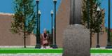
Shadow effect resulting from existing and future development 
Shadow effect resulting from existing and future development


-
Beechwood Cemetery to the St. Patrick's Street Bridge -
Beechwood Cemetery to the St. Patrick's Street Bridge -
Shadow effect resulting from existing and future development -
Shadow effect resulting from existing and future development
Amendment to the Rockcliffe Park Secondary Plan of the City of Ottawa Official Plan
Volume 2A, Village of Rockcliffe Park Secondary Plan
The Statement Of Components
Part A - The Preamble, introduces the actual Amendment but does not constitute part of Amendment No. ___ to the City of Ottawa Official Plan.
Part B - The Amendment, consisting of the following text constitutes the actual
Amendment No. ___ to the City of Ottawa Official Plan.
Part A - The Preamble
1. Purpose
The purpose of this Amendment is to remove the maximum residential density provision (50.00 units per hectare) for specific properties that abut Beechwood Avenue in Rockcliffe Park. This provision is considered as an additional layer and an unnecessary form of development control. Building setback and height provisions are sufficient to regulate development. The amendment is intended to implement the Beechwood Community Design Plan.
This change requires amendment to Schedule A of the Village of Rockcliffe Park Secondary Plan.
2. Location
The lands subject to this Amendment consist of the properties identified by the following addresses, which comprise all of the lands on the north side of Beechwood Avenue within the former Village of Rockcliffe Park between Acacia Avenue and Oakhill Road:
- 2 Acacia Avenue
- 207-259 Beechwood Avenue
3. Basis
The Official Plan (2003) designates Beechwood Avenue as a Traditional Mainstreet and establishes that the preferred method of planning for Traditional Mainstreets is through the adoption of a Community Design Plan. The purpose of a Community Design Plan is to translate the principles, objectives and policies of the Official Plan to specific areas and streets. A Community Design Plan should be prepared in a comprehensive manner in accordance with Figure 2.5.7 of the Official Plan. The Community Design Plan should encourage redevelopment and infill “in order to optimize the use of land through increased building height and density”.
The City has undertaken to prepare the Beechwood Community Design Plan, which has established that some of the Rockcliffe Park properties subject to this Amendment are designated as part of the Planning Area. The Community Design Plan has further established a development strategy for the Rockcliffe Sector, which establishes that these properties are suited to infill development.
It has therefore been determined that the Village of Rockcliffe Park Secondary Plan needs to be amended in order to implement the development strategy contained in the Beechwood Community Design Plan and to take advantage of the fact that the subject properties are located along a mainstreet.
Part B- The Amendment
1. The Introductory Statement
All of this part of this document entitled Part B - The Amendment, consisting of the following text and the attached map designated Schedule “A”, constitutes Amendment No. ___ to the Official Plan of the City of Ottawa.
2. Details of Amendment
The following changes are hereby made to the Official Plan of the City of Ottawa:
- That Schedule “A” – Plan of Land Use contained in the “Secondary Plan for Village of Rockcliffe Park”is hereby amended by removing the references to 50.00 as the maximum dwelling units per hectare in relation to the properties that abut Beechwood Avenue between Acacia Avenue and Oakhill Road except for the property at 490 Oakhill Road.
3. Implementation
The implementation of this Amendment to the Official Plan shall be in accordance with the respective policies of the Official Plan of the City of Ottawa.
Schedule “A” : Village of Rockcliffe Park

Mainstreet Zoning Provisions
The link to the Beechwood Mainstreet zoning provisions in the Comprehensive Zoning By-law will be available in the winter of 2007.