Overview
The Geospatial Analytics, Technology and Solutions (GATS) branch provides expert services and cutting-edge solutions in cartography, analytics, visualization, data management and conversion, applications, and systems integration. They are also responsible for the Digital Twin and Geospatial Data Acquisition and Hardware Program (Reality Capture Mapping). The program is critical for city building initiatives and utilizes advanced technologies such as LiDAR, photogrammetry, UAVs, and 360-degree camera imagery to create high-fidelity 3D models and digital replicas of physical environments, including both indoor and outdoor spaces.
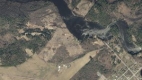
The branch provides critical spatial and non-spatial information to the public such as the water and wastewater network, zoning, aerial mapping and base mapping including LiDAR, engineering drawings, reports, utility drawings and related services.
- Aerial photography, base mapping and LiDAR
- Engineering drawings and reports
- Utility mapping
- Water and wastewater networks
For more information on the Geospatial Analytics, Technology and Solutions branch, contact:
Randal Rodger, Program Manager (GATS)
randal.rodger@ottawa.ca
613-580-2424, extension 13196
For information on how to obtain data, drawings, etc., contact:
GATS - GeoInformation Centre
GeoInformation@ottawa.ca
613-580-2424, extension 44455
Aerial photography, base mapping and LiDAR
The Geospatial Analytics, Technology and Solutions provides the following photogrammetric mapping products.
Please refer to the fee schedule to request these products.
Ortho-imagery
- Ortho-rectified imagery in 1km-by-1km tiled geo-tiff format.
- All imagery 2019 and later is available in NAD83_CSRS
Most recent 6 cm imagery: 2024
Years leaf-on: 2024
6 cm Imagery: 2007, 2009, 2010, 2011, 2013, 2014, 2015, 2017, 2019, 2021, 2022, 2023
Most recent 15/16 cm imagery: 2024
Years leaf-on: N/A
15/16 cm Imagery: 2019, 2017, 2022
Most recent 20 cm imagery: 2022
Years leaf on: 2008, 2017, 2022
20 cm Imagery: 1991, 2002, 2005, 2008, 2011, 2014, 2016, 2017, 2019


LIDAR
- LIDAR data in 1km-by-1km tiles available in LAS and 1m gridded bare earth geo-tiff raster formats.
- All LiDAR 2020 and later is available in compressed LAZ format in NAD83_CSRS.
Most recent LiDAR: 2024/2025
LiDAR: 2006, 2012, 2014, 2015, 2017, 2020

Aerial base mapping products
- Urban 1:1000 base mapping, in 500m-by-500m tiles
- Rural 1:5000 rural mapping, in 5km-by-5km tiles available in MicroStation .dgn and AutoCAD .dwg formats
- Only NAD83 (CSRS) is available for 2019 and later
Most recent 1K vector mapping: 2023
1K vector mapping: 2019, 2017 and earlier
Most recent 5K vector mapping: 2019
2K vector mapping: 2007 and earlier


Digital Twin 3D buildings
- Digital Twin 3D buildings simplified level of detail 1 (LOD1) and level of detail 2.5 (LOD2.5).
3D buildings - LOD1
- LOD1 data is available at OpenOttawa.ca, in .csv. .shp, .geojson, and .kml formats
- LOD1 data is comprised of all structures with a ground surface larger than 10 square metres across the entire city. Extents were generated from the latest footprint envelopes and maximum height from 2020 LiDAR data.

3D buildings – LOD2.5
- LOD 2.5 data is available in .dxf and .fgbd formats, see the fee schedule for cost details.

Engineering drawings and reports
Engineering drawings
GATS provides the following Engineering Services:
- Plan, grading, geometry, pavement elevations, etc.
- Plan and profile indicating the depth of the sewers and water
- Subdivision, composite utility, grading
- Site plans
- Bridge, culvert, retaining wall plans

Engineering reports
- Geotechnical
- Engineering studies, planning studies and reports
For water or sewer service connection information, please call 3-1-1.
To request an engineering drawing or report, email GeoInformation@ottawa.ca or call 613-580-2424, extension 44455
Non-City contracts are subject to a Council approved fee schedule.
Utility mapping
GATS is responsible for mapping of all subsurface municipal and utility agency infrastructure within the Right of Way in coordination with the Ottawa Utility Coordinating Committee. The current dataset features include:
- Water and wastewater pipes and all associated ironworks
- Traffic and streetlighting poles, ducts and all associated ironworks
- Streetscaping, bus shelters, planters
- Utility agency ducts, conduit, cable and or fibre, manholes, handholes, pedestals, poles and Public Works Government Services Canada plants

Please refer to the fee schedule to request a utility plan from the Ottawa Utility Coordinating Committee's Central Registry data.
For assistance, contact the GATS - GeoInformation Centre by email GeoInformation@ottawa.ca or call 613-580-2424, extension 44455
Water and wastewater networks
GATS is responsible for the daily maintenance of both the water distribution system and the sanitary and storm collection systems inventory across the entire City of Ottawa within an enterprise GIS. This data is used by the operating groups and various departments for maintenance purposes, planning and renewal.
Water distribution and wastewater collection systems - interactive map
You can view the Water Distribution and Wastewater Collection Systems interactive map for information that includes the locations of watermains, hydrants, valves, manholes, pipes, inlets/outlets, associated facilities, and related details.
Catch basin locator map
The City of Ottawa has over 100,000 catch basins to provide drainage to our roadways and greenspaces.
As a critical component of the city storm collection system, keeping catch basins clear of debris (leaves, ice, snow, etc.) is important. Find the location of your nearest catch basin using the interactive map and help keep our system operating effectively.
For assistance, contact GATS - GeoInformation Centre by email GeoInformation@ottawa.ca or call 613-580-2424, extension 44455.
Fee schedule effective January 1, 2025
| Administrative fee (applies to all requests) | $ 95 | |
| Aerial photography, base mapping, and LiDAR - Cost per tile | ||
| Aerial base vector mapping, DGN or DWG | $ 166 | |
| Aerial ortho-imagery, TIF | $ 166 | |
| Aerial LIDAR, LAZ | $ 166 | |
| 3D buildings LOD 2.5, DXF or FGBD * *Production of customized tile, map or data may apply (hourly rate) | $ 166 | |
| Engineering drawings and reports | ||
| Engineering drawings, TIF or PDF | $ 17.50 | |
| Engineering drawings, DGN or DWG *Production of customized tile, map, plan or data may apply (hourly rate) | $ 51 | |
| Engineering/geotechnical reports/studies, TIF or PDF *Cost per digital report | $ 39 | |
| Ottawa Utility Coordinating Committee's Central Registry Data | ||
|
$ 51 | |
| Central Registry plans, – .dgn or AutoCAD .dwg | $ 166 | |
| Water Distribution System or Sanitary and Storm Collection System | ||
| Production of customized tile, map, plan or data, hourly rate | $ 132 | |
| General land use maps | ||
| Online store printed map | $17.50 | |
| General land use maps, PDF | $132 | |
Notes:
|
||