Residential Dwelling Approval Pipeline
In an effort to track progress towards municipal, provincial and federal housing supply targets for the city of Ottawa, the Residential Dwelling Approval Pipeline provides an update on housing unit approvals, building permits issued, and other residential development indicators on a quarterly and year-to-date basis. Data will also be posted to Open Ottawa(link is external).
The following update reports on residential development data for Q2 2024, which covers April, May and June.
Quarter 2 2024 [ PDF 170 KB ] Opens in a new tab or window(link is external)
A year-to-date report can also be found below which excludes double counting of housing units approved through multiple development applications at the same location as well as tracks progress towards the Municipal Housing Pledge(link is external) and Housing Accelerator Fund(link is external).
Year to date April to June 2024 [ PDF 183 KB ] Opens in a new tab or window(link is external)
Both the quarterly report and the year-to-date report exclude double counting of housing units approved through multiple development applications at the same location.
Definitions
Additional Residential Units:
The City of Ottawa estimate of additional residential units includes building permits issued for secondary dwelling units, non-residential to residential conversions, coach houses, student housing, and additions or alterations that increase the number of apartments.
Additional Residential Units (ARUs): includes non-residential space that is converted to residential units and residential to residential conversions, for which the province’s housing tracker(link is external) relies on ARUs data(link is external) provided by the Canada Mortgage and Housing Corporation.
Approvals: new dwellings approved through development applications related to lot creation or lot development.
- Minor Variance: an approved deviation from the Zoning By-law that permits development that does not comply to performance standards (e.g. lot size, building height).
- Plan of Condominium: the approved separation of dwelling units or land that may be sold as part of a condominium corporation.
- Plan of Subdivision: the approved separation of land to create more than one or two lots where roads and services are to be created and/or extended.
- Severance: the approved separation of land to create a new parcel that can be bought or sold separately.
- Site Plan Control: a process through which the City of Ottawa ensures that a lot layout is safe, functional, and orderly.
As-of-right: permitted as is, under the Official Plan and Zoning By-law.
Building Permit: in this context, a document issued by the City of Ottawa that permits the construction of or change of use to a residential dwelling.
Coach house: A separate additional dwelling unit that is subsidiary to and located on the same lot as an associated principal dwelling unit, but contained within its own building. These may also contain uses accessory to the principal dwelling.
Completion: a dwelling where all proposed work is now complete. Source: CMHC(link is external)
Demolition Permit: in this context, a document issued by the City of Ottawa that permits the removal of a residential dwelling.
Dwelling: a dwelling unit used or intended for use as a residential premises for one household.
- Apartment dwelling (also referred to as “Apt”): a dwelling unit within a building that has two or more principal dwelling units that are divided horizontally (e.g. a duplex), or a dwelling unit that is subsidiary to the primary unit (e.g. a secondary dwelling unit or coach house). For example, an apartment building will have multiple apartment dwellings.
- Rowhouse dwelling (also referred to as “Row”): a dwelling unit within a building that contains three or more attached principal dwelling units that are divided vertically.
- Semi-detached dwelling (also referred to as “Semi”): a dwelling unit within a building that contains two attached principal dwelling units that are divided vertically. For example, one semi-detached building will have two semi-detached dwellings.
- Single detached dwelling (also referred to as “Single”): a dwelling unit within a building that contains only one principal dwelling unit.
Land Use Permissions: a change to what a parcel or piece of land may be used for under land use policy.
- Official Plan Amendment: an approved change to policies and/or designations within the Official Plan. The Official Plan is a broad guideline of land use and development in Ottawa.
- Zoning By-law Amendment: an approved change to the current Zoning By-law in terms of land use. The Zoning By-law outlines how a specific parcel of land may be used.
Long-term care bed: A new or upgraded bed in a long-term care home that is licensed or approved to be occupied by one resident each.
Net dwellings: the number of dwelling units that have been issued building permits minus the number of dwelling units that have been issued demolition permits, to calculate true supply growth.
Non-residential to residential conversion: A pre-existing building that, historically, was not occupied as a residence (for example, a church, office or warehouse) and that is converted for residential use.
Not-for-profit dwellings: Housing owned and/or operated by a not-for-profit or charitable housing organization that has received funding through the City of Ottawa from municipal, provincial, and/or federal funding programs.
Secondary dwelling unit: A self-contained apartment or small residential unit located within an existing single detached, semi-detached or row house (for example, a basement suite).
Start: a housing start, defined as the beginning of construction work on the building where the dwelling unit will be located. Source: CMHC(link is external)
Student housing: A form of accommodation that university or college students can choose as an alternative to on-campus housing.
Under Construction: a dwelling that is under construction as of the end of the reporting period. Source: CMHC(link is external)
Ottawa's Official Plan and Master Plans show the way
For a quick introduction to the planning process watch the I Saw the Sign Land Development video.
• Can they build anything here?
• What do I think about this?
• I think I will call the planner and ask
• I am so glad you called – I would be happy to explain land development in Ottawa
• In the beginning…no, not that far back...the Province of Ontario directs that all city’s have an Official Plan which is reviewed and updated every five years
• The Official Plan broadly describes what can be built, how and where, such as :
• In urban, rural and suburban areas
• How populated an area should be
• Where business and industry should be located
• How much parkland is required
• Transportation roads, cycling paths and sidewalks
• And how cultural areas and natural features are protected
• To put the Official Plan into action we need to be more specific.
• Various areas throughout the city have secondary plans and community design plans to help guide development in that area.
• Ultimately, the Zoning By-law implements the policies in the Official Plan. Each parcel of land is designated with a code for specific uses – residential, commercial, industrial, and agricultural to name a few.
• The zoning for each property determines the height of buildings, the set back from the street, greenspace required, parking and type of building
• When someone wants to develop a property they must meet with City staff. Many studies and plans will be required to ensure that good engineering, design and environmental considerations are in place.
• An applicant may also apply for a zoning by-law or official plan amendment to adjust the use of the property – these amendments must be approved by City Council.
• In this case, the City has received an application to develop the property and also for a zoning by-law amendment – the sign is then placed on the site.
• When you see these signs, applications are being reviewed by City staff, technical agencies, Community Associations and Ward Councillors - the City is looking for your input too.
• This is where you can get involved. A public meeting is required for some development applications to give the community a chance to learn about the project and provide comments.
• You have already taken the first step by calling for information. Attend a meeting to provide your comments and hear from others.
• These applications are also provided on the City’s website.
• City Council makes the final decision for zoning and official plan amendments.
• Where Council allows, most other planning applications are approved by the department.
• Where appeals can be made, they are heard by the Ontario Municipal Board
• Want to learn more about land development in the City of Ottawa – visit Ottawa.ca/planning or sign-up to attend Planning Primer – a complimentary session on the Planning Process.
• So next time you See the Sign – give us a call!
How policy shapes your community
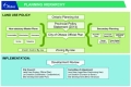
- Official Plan
- Transportation Master Plan
- Infrastructure Master Plan
- Ottawa Cycling Plan
- Ottawa Pedestrian Plan
Together, these five plans set the vision for Ottawa's future growth to 2031. They were developed in an integrated way, recognizing that they all complement each other and work together to create a vibrant, more liveable Ottawa.
The Official Plan provides a vision of the growth of the city and a policy framework to guide its physical development to the year 2031. It sets out how and where the City will focus residential, commercial and employment growth. It is a legal document that addresses matters of provincial interest defined by the Provincial Policy Statement under the Ontario Planning Act. It is also the basis for municipal activities such as:
- Planning and approval of public works (such as roads and parks)
- Comprehensive zoning by-law (implements many of the policies of the City’s Official Plan)
- Creation of community design plans for areas within the City of Ottawa
- Review and approval of development applications (activities that result in a change of land use or the construction or addition to a building(s) or to the creation of a parcel of land)
Transportation Master Plan
The Transportation Master Plan (TMP) identifies the transportation facilities, services and policies that the City of Ottawa will implement to serve a projected population of 1.14 million people by 2031. It sets direction for the City's day-to-day transportation programs and provides a basis for budget planning that is consistent with the growth management policies of the City's Official Plan.
Infrastructure Master Plan
The Infrastructure Master Plan (IMP) plans for the efficient management, responsible operation and targeted growth of water, wastewater, and stormwater infrastructure. It supports the Official Plan by ensuring there is enough infrastructure capacity in the right areas of the municipality at appropriate service levels and at the right time to accommodate development and redevelopment to 2031.
Ottawa Cycling Plan
The 2013 Ottawa Cycling Plan (OCP2013) is a long-term strategy to strengthen and support cycling in the city. It provides an overarching vision for cycling in Ottawa, sets key objectives, identifies a comprehensive cycling network and supportive operational activities and recommends policies to guide cycling facility planning, design, implementation and maintenance.
Ottawa Pedestrian Plan
The 2013 Ottawa Pedestrian Plan (OPP 2013) has been developed to recognize the crucial role that walking plays in creating an attractive, accessible, liveable, safe and healthy city. It provides detailed direction on how, within an affordability framework, the City can become more pedestrian-friendly through proposed enhancements to the pedestrian network, planning and design, safety and promotion, and maintenance and rehabilitation.
Reaching into every neighbourhood
These plans have a direct impact on your city, your neighbourhood and your family:
- How the city is developed
- Where employment areas can be built
- What the roads and sidewalks are like
- What transit is available
- Housing options
- Greenspace
- Water and sewer installations
These are issues that reach every resident in the city – get involved! Take a look at what’s happening in your neighbourhood, discover how planning works, review how Ottawa is meeting the challenges of growth, attend a public meeting or just ask a question.
Planning branches
Community Planning
The Community Planning unit is tasked with the big-picture planning for our city and the more detailed neighbourhood plans that guide the evolution of the areas where most change is anticipated. The unit prepares the City’s Official Plan, the Community Design Plans and Secondary Plans for intensification target areas, and Transit-Oriented Development Plans at key locations along the rapid transit network.
Development Review
The Development Planning staff provides professional planning services with respect to current land use issues and undertakes the review and processing of a variety of development applications, Official Plan, Zoning, Subdivision, Condominium, Part Lot Control and Site Plans submitted to the municipality. Development Planning staff are available to provide consultative assistance to the public and the development industry on planning-related issues, processing of development applications and the planning legislative process.
Heritage Program
Heritage planning is the preservation, conservation, rehabilitation, restoration and management of heritage resources. Cultural heritage resources can include sites, structures, buildings, and landscapes of historic, architectural or contextual value. Heritage planners work to manage change throughout the city to ensure that cultural heritage resources are retained, protected and integrated into new developments.
The City of Ottawa conserves significant cultural heritage resources to celebrate, revitalize, stabilize and enhance the community as well as to contribute to its physical, social, cultural and economic development. The City has over 300 individually designated buildings and 18 heritage conservation districts.
The Heritage Services Section is responsible for researching and evaluating properties and areas for designation, assisting property owners with restoration projects, evaluating applications for alterations and demolition under the Ontario Heritage Act. The Section provides expert advice to the Built Heritage Sub-Committee, Planning Committee, Agriculture and Rural Affairs Committee and City Council on built heritage matters.
The Heritage Services Section maintains the City's Heritage Register which includes designated properties and properties listed under Section 27 of the Ontario Heritage Act. The City also maintains a Heritage Reference List which lists over 10,000 properties of heritage interest in Ottawa.
Infrastructure Policy Planning
The Infrastructure Policy Unit is responsible for the development of the City’s Infrastructure Master Plan and managing the implementation of the projects, policies, and actions described in the plan including:
- Major growth-related water distribution and sewage collection infrastructure
- Stormwater management strategies and retrofit infrastructure
- Rural services and groundwater management strategies
The unit’s scope also includes major water and sewer projects that are primarily intended as level of service upgrades, but also meet projected growth demands as a secondary objective. The Infrastructure Policy Unit also manages the floodplain mapping program, playing a leading role in establishing methodologies, priorities and evaluating risks to the public, in cooperation with the Conservation Authorities
Linkages to major infrastructure planning include:
- Reviewing Master Servicing Studies that support Community Design Plans and Transit Oriented Development Plans to ensure compatibility and compliance with the City’s major infrastructure plans and level of service objectives
- Reviewing all water, sewage and stormwater engineering submissions associated with subdivision applications and many site plans for development outside the Greenbelt
- Developing and managing environmental data needed to support subwatershed, development and municipal project planning
Natural Environment Plans and Programs
The Land Use and Natural Systems (LUNS) Unit develops and implements policies and guidelines to sustain the natural environment for current and future generations. Projects include official plan policies and guidelines, master plans and studies, development review and engaging with stakeholders including Councillors, government agencies, community groups, residents and the development industry.
In our city we enjoy many natural areas, woodlands, rivers and creeks that contribute in large measure to a high quality of life. The network of greenspace supports healthy watercourses, protects biodiversity, improves air quality and helps combat climate change.
As our city grows and changes, our objective is to support a planning process that respects natural processes and integrates environmental considerations into decision making and design.
Program Areas include:
Increasing and Enhancing Forest Cover
Develop an Urban Forest Management Plan (UFMP) to provide a comprehensive and strategic approach to protecting, maintaining and enhancing the urban forest.
Acquiring and Protecting Natural Areas
Make recommendations to Council regarding the acquisition of natural areas.
Maintain Biodiversity
Developed the Wildlife Strategy and the revision of the wildlife construction protocol to reflect the current City of Ottawa Official Plan and by-laws, and provide more guidance for avoiding wildlife issues.
Development
The Land Use and Natural Systems Unit works with stakeholders and the development industry to create subwatershed plans or environmental management plans priors to consideration of new development or community design plans.
Development Review
As part of the development review process, at the pre-consultation stage, environmental planners identify what natural heritage components are present , what studies need to be prepared and provide advice.
Transportation Planning
The Transportation Planning Branch is responsible for developing strategic transportation plans for pedestrians, cyclists, transit and motor vehicles.
Strategic Transportation Planning
- Transportation Master Plan
- The Transportation Master Plan (TMP) identifies the transportation facilities, services and policies that the City of Ottawa will implement to serve a projected population of 1.14 million people by 2031. It sets direction for the City's day-to-day transportation programs and provides a basis for budget planning that is consistent with the growth management policies of the City's Official Plan.
- The Ottawa Cycling Plan (OCP) is a long-term strategy to strengthen and support cycling in the city.
- Ottawa Pedestrian Plan (OPP ) is a strategy to reinforce walking needs through proposed enhancements to the pedestrian network, planning and design, and maintenance and rehabilitation.
- Identification of future transportation infrastructure requirements and their capital costs (all modes)
- Monitoring implementation progress of strategic plans
- Identifies land and corridor requirements for transportation facilities
- Transportation Demand Management
- Data collection and data analysis (i.e. Origin-Destination Surveys)
- Transportation demand modelling and forecasting
- Development and monitoring of transportation policies (i.e. modal share targets)
- Plans and coordinates the implementation of pedestrian and cycling facilities and the delivery of the Transportation Demand Management program.
- Environmental Assessments
- The Branch undertakes environmental assessments to ensure proposed transportation projects are environmentally responsible and have regard for social, economic and cultural impacts.
- Undertakes functional design and environmental assessments for transportation facilities to service growth (i.e. rapid transit, arterial roads)
- Area Traffic Management
- The Branch also undertakes area traffic management studies and implements the recommendations to ensure that the impact of motorized vehicles on neighbourhoods is minimized and to improve safety and quality of life for all street users.
Urban Design
The Urban Design unit develops policy and guidelines for urban design in Ottawa. They also support the Urban Design Review Panel who provide an objective peer review of both capital and private sector development projects throughout the City’s Design Priority Areas.
Challenges of Growth
“Ottawa shines as both a national capital and as a great place to call home.”
Ottawa is unique among Canadian cities because its boundary takes in an urban area surrounded by a large and varied countryside. Located at the juncture of the Ottawa River and the Rideau River and Canal, these waterways are the hallmarks of Ottawa.
The city is currently on track towards a projected population of 1.1 million in 2031, an increase of 30 per cent over 2006. Population change creates new patterns of growth in Ottawa. Projected growth is strongest outside the Greenbelt, but the area inside the Greenbelt continues to contain the greatest concentration of people and jobs.
Both young and old are already seeking more urban lifestyles, creating a boom in apartments in communities that offer street life, great views, and good places for walking and cycling. In 2011 almost two-thirds of households in Ottawa were small and contained only one or two persons.
Villages continue to attract newcomers and as well as families with deep roots in the rural area. Rural Ottawa is expected to continue to receive about 10 per cent of the city’s growth.
The population will become older as well as more diverse. The number of people over 65 will double from about one in 10 in 2006 to one in five in 2031.
Planning the Future, Building it Now
Everything we build today needs to fit our vision for tomorrow.
Building a liveable, sustainable city is the goal of this vision:
- A network of communities where residents can live, work and play
- Connected by affordable, reliable and functional cycling, transit, pedestrian and road systems.
The building blocks of this vision include:
- Build in, not out
- Protect the countryside
- Move people when and where they need to go – sustainably
- Create people-friendly environments
- Support economic development
- Preserve the environment
- Provide water and wastewater infrastructure where it’s needed
- Live within our financial means
How Ottawa is developing to meet the challenge
The official plan and master plans are reviewed every five years. The last review was approved by City Council on November 26, 2013. Many issues and solutions were examined and as part of the review:
Build In, Not Out
Ottawa is made up of both urban and rural land. Urban land includes all the land surrounded by the Greenbelt plus all the land in suburbs in Kanata, Barrhaven and Orléans. The City provides transit, roads, and water and wastewater services within the urban area to support new communities and economic development.

The Urban Boundary separates urban land from rural land in the Official Plan. A key planning goal of the City is to grow in a way that minimizes the need to expand the urban boundary by making the best use of the urban land we already have. Compact housing has been increased in new neighbourhoods through the variety of units and available housing choices. Throughout the city, more jobs and housing are encouraged in existing areas in a way that protects the character of established neighbourhoods. This concept is referred to as intensification.
Why is it important to build within the urban boundary?
- Building within the boundary is more affordable than expanding it because it uses the infrastructure we already have paid for and reduces the need for expensive new infrastructure
- New development creates exciting new communities around the rapid transit system and rejuvenates aging shopping and residential areas—a plus for residents and the economy
- Walking, cycling and transit are easier in a compact city
- A compact city supports walking, cycling and transit and uses less energy, land and resources
Protect the Countryside
Ninety per cent of the land area in the City of Ottawa is rural. It is home to dozens of communities and contains a wealth of mineral resources, agricultural land, extensive forests and wetlands:

- Villages - There are 26 villages in rural Ottawa, each with a unique character and history
- Country lots - Country lots in the rural area outside the villages range from large, well-treed holdings to subdivisions of large lots similar to suburban developments
- Agricultural lands - These lands are farmed for food and resources to the benefit of Ottawa’s residents and for export
- Mineral aggregate resources, especially bedrock, sand and gravel - These are used to build and repair houses, schools, roads, sewers and all the other structures in the city. Aggregates are an essential non-renewable resource that the City will steward for future generations.
- Natural Heritage System – Forests, wetlands, rivers and other natural features create a system that extends throughout the rural area and into the urban area.
The Official Plan envisions that at least 50 per cent of rural growth will occur in villages where stores, commercial services, schools and community facilities are concentrated. Building complete communities in villages makes the best use of existing resources and curbs the need for new infrastructure and services. It is the most affordable growth option for residents and the municipality.
Why is it important to protect the countryside?
There are potential conflicts between the ways we use rural land. Competing uses need to be balanced if we are to preserve the value of the rural area.
- Steady population growth in the rural area shows that many Ottawa residents value this option.
- Agriculture is the mainstay of the rural economy and preservation of agricultural land is the first step towards protecting the ability of future generations to produce the food they need.
- An ongoing, inexpensive supply of mineral aggregates helps to minimize construction costs and supports local economic development.
- The natural heritage system is a complex ecosystem that provides us with clean air and water.
Move People When and Where They Need To Go--Sustainably
Whether we choose to walk, cycle, take public transit or drive, each option has an impact that needs to be considered when making decisions about the future of the city.
Although the percentage of people choosing to walk, cycle or take transit in Ottawa continues to increase, close to half of these trips will likely be made by car in the year 2031. The roads and parking facilities needed to accommodate that travel should be as safe and efficient as possible.

The City is also investing in public transportation and active transportation, such as walking and cycling, as attractive alternatives to car travel. These sustainable alternatives are more affordable and have less environmental impact today and in the future.
Sustainable transportation works best when the surrounding area is designed to support it. The City supports more dense housing with employment and services around rapid transit stations and along transit corridors. This approach makes the best use of infrastructure investments and builds vibrant new neighbourhoods.
Design policies for these areas support the development of streets and public spaces that are safe and attractive for pedestrians and cyclists. Streets are designed as complete streets, that accommodate the needs of all users, whether they choose to walk, bike, drive or take public transit.
Complete streets could have wider sidewalks, bike lanes or dedicated bus lanes. Depending on the street, improvements could include smaller changes such as longer crosswalk signals that make it easier for older adults to cross the road, sheltered bus stops, or trees and benches to make a street more pleasant to use.
Why is sustainable transportation important?
The sustainable transportation choices we make will improve the quality of life in Ottawa for current and future generations. Some of the important benefits of sustainable transportation include:
- Making Ottawa a healthier place to live by promoting physically active lifestyles
- Enhancing the sense of community by building walkable neighbourhoods
- Reducing fossil fuel consumption, which saves the City money and reduces greenhouse gas emissions
- Providing affordable access to schools and universities, businesses, the workplace and Ottawa attractions by all residents, employees and visitors
- Reducing traffic congestion and its economic and social costs and increasing transportation safety for all residents
Create People-Friendly Environments Through Urban Design
Urban design is about how buildings, landscapes and public spaces interact to make new developments and the public spaces around them more attractive and functional for people. It is part art – designing beautiful spaces – and part planning – developing policies and rules that determine how built areas can best meet the needs of residents and businesses.

Good design supports sustainable development. It supports intensification by guiding the development of larger buildings that complement the character of the surrounding, established community. It builds complete streets, designed to accommodate the needs of all users. It provides a comprehensive approach to streets and public spaces that support walking, cycling and transit and that together, create a vibrant public realm.
As Ottawa grows, we need to make sure our communities keep their special character. Attractive, sustainable communities are created when they respect the landscape and its natural features and their look and feel reflects local values, history and culture.
Why is urban design important?
- Ottawa’s future depends on growing within our urban spaces and increasing our use of transit and active transportation. Good urban design helps make it work.
- Good design creates safe public spaces and supports an active lifestyle where people feel comfortable enough to walk, cycle and use public transit.
- Attractive, vital urban spaces draw tourists and support business and employment.
- Villages, suburbs and established inner city neighbourhoods each has a unique character that can be captured and expressed through good urban design.
- An aesthetically pleasing and functional environment enriches residents’ quality of life and makes Ottawa a good place to do business.
Support Economic Development
What is employment land?
Maintaining an adequate supply of suitable employment land that has the required water and sewer services is essential to the future economic prosperity of Ottawa and the quality of life of its residents. As Ottawa grows, the City needs to make sure the land reserved for employment is suited to the needs of businesses and is located in the right area. The City may consider changing the permitted uses of employment land not currently being used, including adding residential development options where they create affordable, liveable communities close to public transit and jobs.

Why does employment land matter?
Employment land provides businesses with the land needed to conduct their activities now and in the future. Employment land:
- Supports economic development and job opportunities, from jobs in advanced technology to jobs in construction, trucking, and warehousing/distribution
- Is easily accessible from surrounding communities and makes it easy for people to work close to where they live
- Includes suitable sites for activities that are incompatible with most other uses because of noise, light, hours of operation or other characteristics (away from suburban neighbourhoods)
- Creates signature addresses for businesses (e.g. Kanata Research Park) which encourage business development in a specific area
Preserve the Environment
The environment is the collection of support systems that makes the lives of humans and other species possible. It is the air we breathe, the ground beneath our feet, the water we drink, and the energy that heats our homes and powers our society. The challenge in planning for the environment is to anticipate how these processes and interactions are affected by human activity and to act so that their integrity can be preserved under changing conditions.

Why is preserving the environment important?
The City works to preserve and enhance its environment for all residents by:
- Improving air quality and reducing greenhouse gas emissions
- Identifying and protecting natural features and prime agriculture land and ensuring mineral resources are used carefully
- Planning on the basis of the natural systems defined by water systems
- Managing groundwater resources
- Planning for forests and other greenspaces.
Provide Water and Wastewater Infrastructure Where It’s Needed
Ottawa’s infrastructure provides clean drinking water, removes wastewater and manages storm water so that the water quality in receiving creeks is maintained and property is protected from over-land flows during major rainfalls. These essential services are fundamental to the health and safety of residents and the economic life of the city.
As Ottawa grows over the next decade, the City must plan the new infrastructure required to support growth and manage and upgrade existing infrastructure. Both demands must be balanced against the City’s available financial resources. By monitoring where population and employment growth is occurring, the City can deliver infrastructure services in the right place, at the right time and at the lowest cost.
Why is Infrastructure Important?
Every community requires basic infrastructure services. Water and wastewater infrastructure:
- Helps protect the quality of water in the rivers and streams that ultimately receive runoff and discharged wastewater
- Protects public health
- Helps communities adapt to climate change and changing weather patterns by managing stormwater flows
- Supports economic development and the quality of life that helps Ottawa attract mobile, highly-skilled workers
Live Within Our Financial Means
The City currently receives most of its revenue from two sources: property taxes and development charges.
Property taxes are collected from property owners to fund improvement and maintenance to current infrastructure, such as bicycle lanes and roads.
Development charges are one-time fees paid by property owners when new building permits are issued. These charges are used to help fund new roads and municipal services needed to support new development.

Additional funding can also come from the provincial and federal governments, as is the case with Ottawa’s Light Rail Transit system.
Why is living within our financial means important?
Much like any household, the City must ensure expenditures do not exceed income and make choices that are within its financial means. The cost of new growth and the cost of maintaining infrastructure and consistent service levels must be balanced across the city.
The City will use a variety of techniques both in revenue generation and cost avoidance to make sure growth pays for itself:
- The City will make sure sources of revenue can support proposed project costs
- The City will review the list of projects it wants funded against the resources available and prioritize these projects.
- The City will make decisions based on what projects get funded and in what timeframe, based on the type of revenue it receives.
- The City will be fiscally responsible and financially sustainable over the long term. It will focus on strategies to ensure infrastructure renewal needs are met and new sources of funding and techniques are secured to make growth pay for itself.
FAQs
How can I find the zoning of a piece of property in my neighbourhood?
You can contact a Client Service Centre and ask to speak to a development information officer.
Can I make an appointment to meet with a City Planner to discuss a particular development application?
Yes. You can meet with the assigned planner to discuss a specific development application. Call the development information officer who can direct you to the Planner for your neighbourhood or the neighbourhood in which the proposed development is located. You will also find the assigned Planner's name (both English and French speaking), their telephone number and extension on the on-site sign. Often a telephone call will suffice, but if you wish to meet with the Planner that can also be arranged.
Development information officers
In order to provide effective service to clients, the Development Information Service is changing, as of August 1, 2023, in-person service will be available by appointment only. If you require the services of a development information officer, please call 613-580-2424, extension 23434 or email dioinquiry@ottawa.ca(link opens email application), include the subject address, proposed use, and other pertinent information relevant to the inquiry. Upon receipt of the inquiry, a phone call or an email response will be provided within 2 to 3 business days, in the event more information is required there will be options to allow for further discussion.
If I have objections to a particular development application should I deal with the planner, the Ward Councillor or both?
If you have objections to a development application, it's a good idea to talk to both a planner and your Ward Councillor. In this way, you are sure that your comments and concerns are being heard at different levels within the City and hopefully resolved to your satisfaction.
Should my community organization contact the applicant or developer directly or go through the planner?
It's best to contact the assigned planner because this person has all the information regarding the development application and can give you direction on how best to obtain further information from the applicant.
What influence can I have when an application is made to develop a vacant piece of land that has been zoned for the projected use but has been vacant and used by the community as open space for a long period of time?
Quite often, pieces of land will remain vacant for several years until such time as the owner of the land decides to develop the property. Although the land has been vacant, the zoning for the proposed development may have been in place for years.
Because the land is vacant and has been used by the surrounding community as an open space this does not mean it is zoned for that purpose. The owner has the right to develop the property in accordance with the original zoning. However, the City encourages dialogue between developers and community organizations. Through dialogue, it is often possible to make changes to a proposed development that makes it more compatible with the community's wishes
Large development applications usually have technical studies associated with them. Can my community request copies of a certain study?
Yes. Your community organization representative can request copies of any technical study associated with a development application. These requests should be made through the assigned planner responsible for the development application in which you or your community organization is interested.
What are those white signs that I see posted on a property in my community?
Under the Public Notification and Consultation Policy, a sign must be posted on the property that is the subject of a certain development application. These on-site signs are another means by which the City informs citizens in the surrounding community about development proposals and applications. The City has an on-site signage procedure that ensures a consistent standard for the content, format, production, installation, maintenance and removal of these on-site signs.
Should a community organization retain the services of their own planner or lawyer?
Certainly there have been situations in the past when community organizations have retained their own planning and legal advisors to give them opinions and advice on a particular development application or a planning issue of concern to the community. If your community organization feels strongly enough about an issue, retaining professional expertise to assist them may be an option to consider.
Glossary of terms
Agreement
A legal agreement between an applicant and the City of Ottawa. These agreements usually contain a range of conditions or actions that the applicant has agreed to undertake in order to received approval of their development application. Most frequently involve Plans of Subdivision and Site Plans.
Appellant
The individual or organization that appeals a development application or proposal.
Applicant
The individual or organization that files a development application with the City .
Assigned Planner
A professional planner with the City of Ottawa who is assigned to manage a specific development application.
Building Permit
A permit issued by the City of Ottawa, required for the construction of a new building or structure, for additions, fireplaces and woodstoves and for most alterations to existing buildings.
Committee of Adjustment
An independent Committee appointed by the City to review and approve applications for severances, minor variances and other related development matters.
Community "Heads Up"
Term used to describe the early notification to the Ward Councillor and community organization about a development application in their area.
Community Information and Comment Session
A meeting held to inform a community about a development application and to obtain comments from the community about that application.
Consent
A consent or severance is the authorized separation of land to form two or more new adjoining properties. Required for the sale, mortgages or lease (for more than 21 years) of a newly created parcel of land.
Delegated Authority
The transfer of the authority to approve certain types of development applications from City Council to Committees of Council and to staff.
Design Priority Area
Mixed-use nodes and corridors that are significant to the City’s overall design. They include the downtown precinct, traditional mainstreets, arterial mainstreets, mixed-use centres, town centres, village cores, community design plans and capital projects. They are subject to design review by the Urban Design Review Panel.
Development Application
A general term used to describe any formal application involving planning and development matters over which the City has approval authority.
Letter of Undertaking
Letter signed by a property owner, when a legal agreement is not necessary, whereby the owner agrees to complete a residential development or a minor non-residential development according to plans and conditions approved by the City.
Minor Variance
Term used to describe a situation where an owner's property is allowed to be used in a way that does not comply exactly with the requirements of the Zoning By-law. The Committee of Adjustment grants approval for a minor variance.
On-Site Sign
Mandatory signage posted on a piece of property that is the subject of a development application. Part of the public notification process related to development applications.
Ontario Land Tribunal (OLT)
The Ontario Land Tribunal (OLT) is an adjudicative tribunal that hears cases in relation to a range of municipal planning, financial and land matters.
Plan of Subdivision
A plan that clearly outlines all details that are required to develop a parcel of land into a subdivision with individual properties.
Planning Committee
A Committee of City Council that reviews most development applications and policy matters related to planning and development of all property within the city.
Registered Community Organizations
A Community Organization that is registered with the City of Ottawa and receives notification about development applications in their area.
Severance
The authorized separation of land to form two or more new adjoining properties. Also see "Consent".
Site Plan
A graphical plan of a proposed development illustrating all the features of the development including dwellings, commercial establishments, roads and other public infrastructure. Usually accompanies all major development applications.
Technical Circulation Package
Package of information compiled by the City and distributed to various public bodies and other agencies to obtain comments on a particular development application.
Urban Design Review Panel
An independent, volunteer advisory body comprised of design professionals for peer review of development applications in Design Priority Areas
Annual Reports
- 2022 Planning, Real Estate and Economic Development Highlights
- 2021 Planning, Infrastructure and Economic Development Highlights
- 2020 Planning, Infrastructure and Economic Development Highlights
- 2019 Planning, Infrastructure and Economic Development Highlights
- 2018 Planning, Infrastructure and Economic Development Highlights